Tuesday, July 29, 2008
Hazen, ND to Washburn, ND
41 miles (6726 total miles)
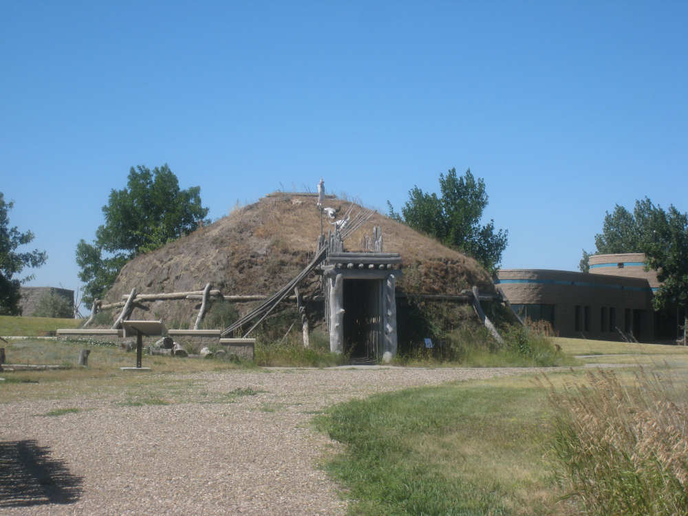
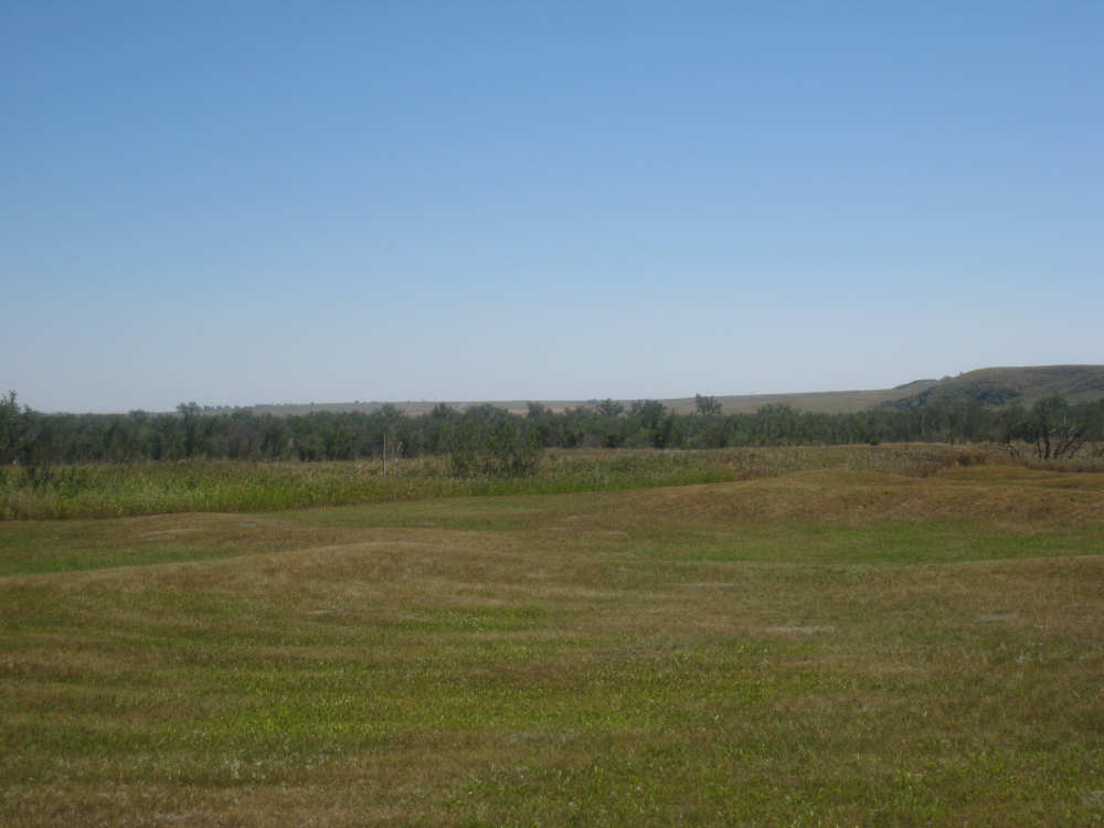
The difference between yesterday and today was night and day - today was sunny, not a cloud in sight, with a strong tailwind. Very pleasant riding. We left around 8:50 after a very pleasant breakfast with Les & Jerine, and stopped at the grocery store in town to stock up on bananas and cookies, which we'd run out of. Then we headed east until the turnoff to Stanton, where we turned north to go visit the Knife River Indian Village exhibit. This exhibit preserves the sites of the Hidatsa, Mandan, and Arikara Indian villages that had been located there for periods ranging from 1400-1845. Lewis & Clark spent a winter in the area at nearby Fort Mandan and developed a good relationship with the natives living there. The structures which the Indians lived in were primarily earthlodges, large round earthen structures reinforced by timber. They seemed to be very well constructed, warm and yet well-ventilated. The impressions left by these structures were round depressions in the earth, presumably just packed down from people living inside them. The depressions are a bit hard to see from the ground but are clearly visible from aerial views.
We stopped for lunch in Stanton although it was a bit early and were surprised to see the cafe full of people. We joined a guy who had been doing road work on the road into Stanton this morning and he asked if we were the couple on the tandem bike he had seen ride by. We also found out the answer to a question that had been bothering Pat for some time - why are there always windsocks at oil pump locations? The guy at the next table overheard us asking about it and said it was because of the hydrogen sulfide gas that's commonly found there. He remarked that you would want to be sure to be upwind of that deadly gas if you were around it.
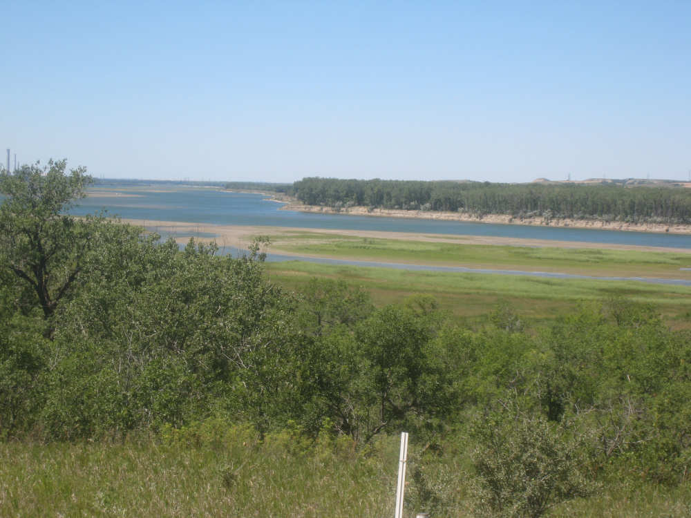
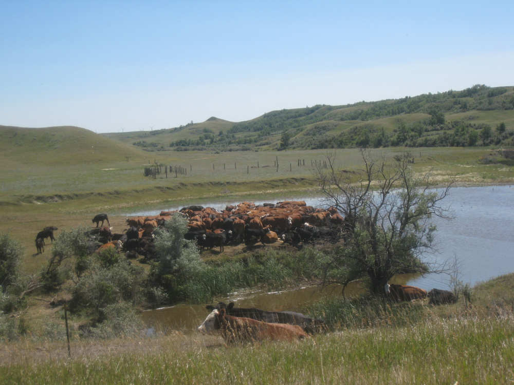
After lunch, we got back on Rt. 200 (alternate) and headed toward Washburn and the Missouri River. This stretch was fairly uneventful until we reached the river, except for seeing a bank of windmills turning in the distance at one turn in the road. We also saw a very wide house being transported, and a group of cows enjoying a dip in a stream. As we neared the river, we also went by Mandan Lake, a small lake nestled among hills, with a beautiful deep blue color. We also passed a wetlands area. The river itself looked very low. Les had told us that the rainfall had been extremely low for the last 5 years and had just gotten better this year, so water levels in general were low. In any case, it was still a lovely river. We had a long climb into Washburn on the other side of the river. The North Dakota Lewis & Clark Interpretive Center was to our left as we approached Hwy. 83 and our motel was on our right. We opted to go to the motel first and unload and then head back to the Interpretive Center. The center was supposed to be open until 7 (summer hours) we were told, but when we got there, they said it was closing at 5, so we only had about a half-hour to tour it. The main exhibit was fairly small, though, with some additional art exhibits which we did not go through. The exhibit dealt primarily with Lewis & Clark's dealings with the local Indians, the 3 tribes discussed at the Knife River exhibit. It also had a lifesize replica of a partially-made dugout canoe, being carved out of a cottonwood log. The enormous statues in front of the center, Lewis & Clark in formal attire meeting with an Indian chief, were among the highlights of the center.
After that, we went to dinner at a nearby bar and then back to the motel to work on the site. We ended the day at under 41-1/2 miles in under 4 hours of bike time - what a difference a tail wind makes! We also slipped back into Central Time, probably when we crossed the Missouri River into McLean county, although they didn't have a sign about it. We think we'll be staying in Central now, but it's hard to tell. We seem to be having connection problems so the pictures may be a while in coming up.

The Welcome to Stanton has a silhouette of Sakagawea and her baby |

Other silhouettes of Sakagawea adorn the lampposts in town |
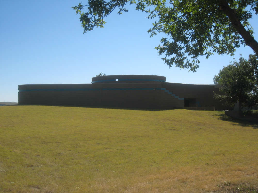
The Knife River Indian Village exhibit hall building... |
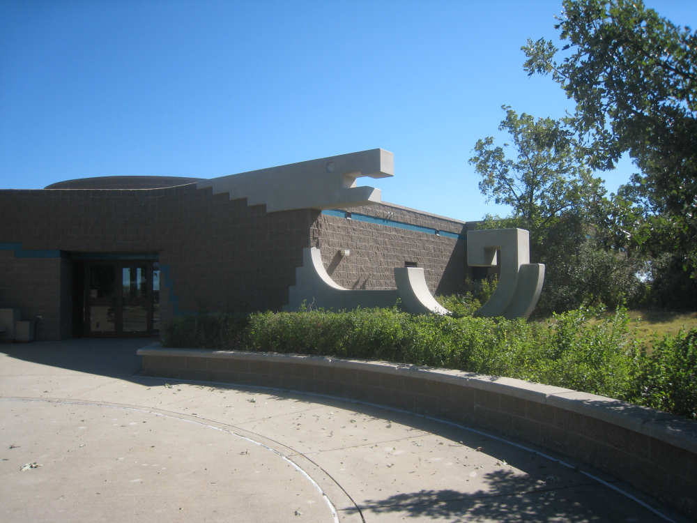
and its interesting entrance |
Views of the depressions made by the earthlodges in some of the villages |
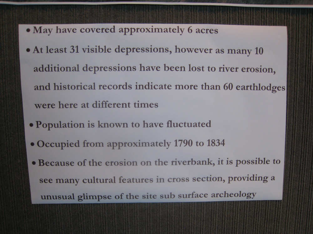
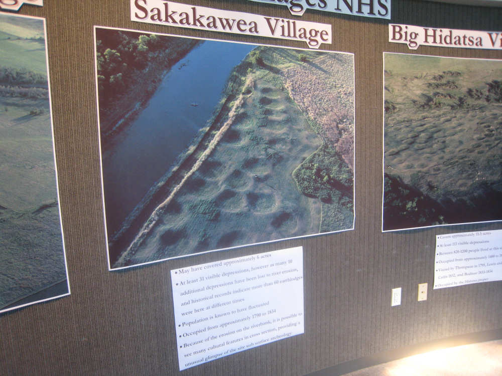
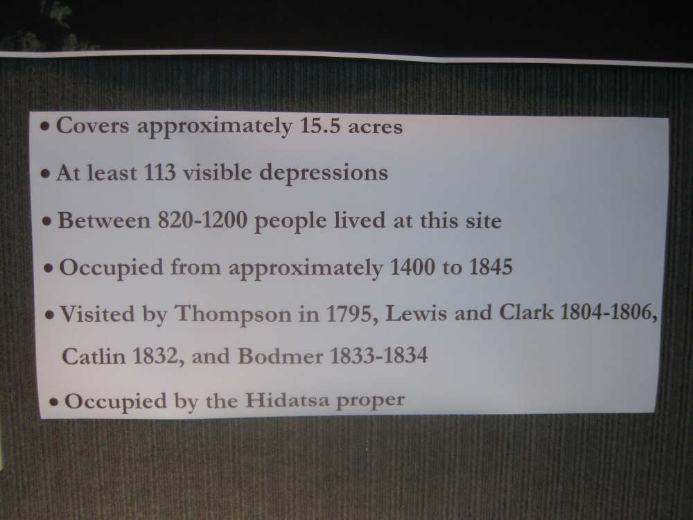
Data on two of the villages depicted above |
|
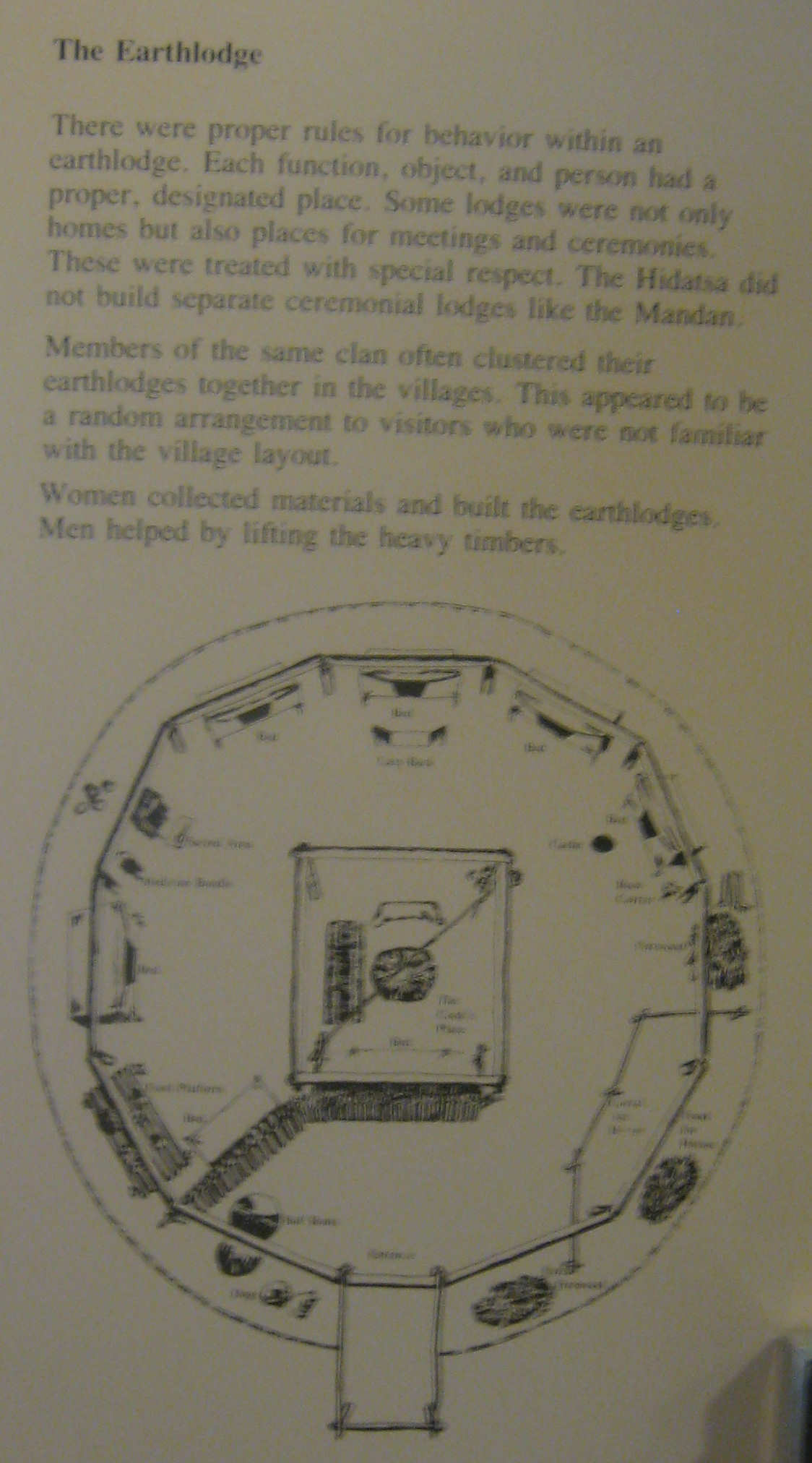
A diagram and description of an earthlodge |
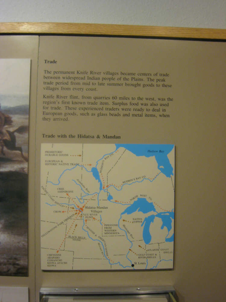
The Knife River area was an important trade center; |
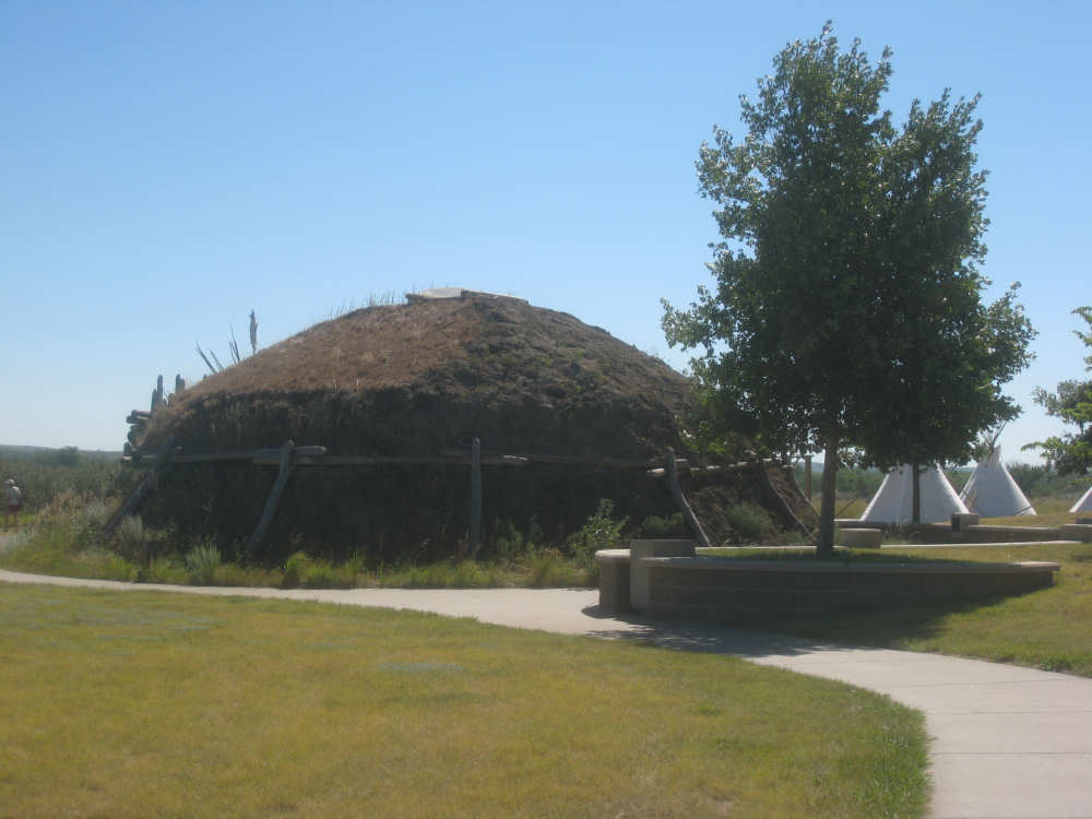
The back of an earthlodge |
The front of the earthlodge |

The entrance - a buffalo hide serves as the door |
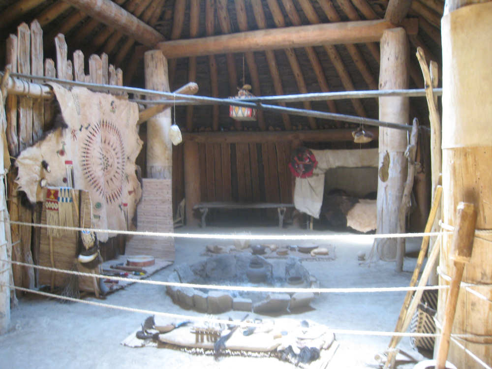
The main room and fire pit |
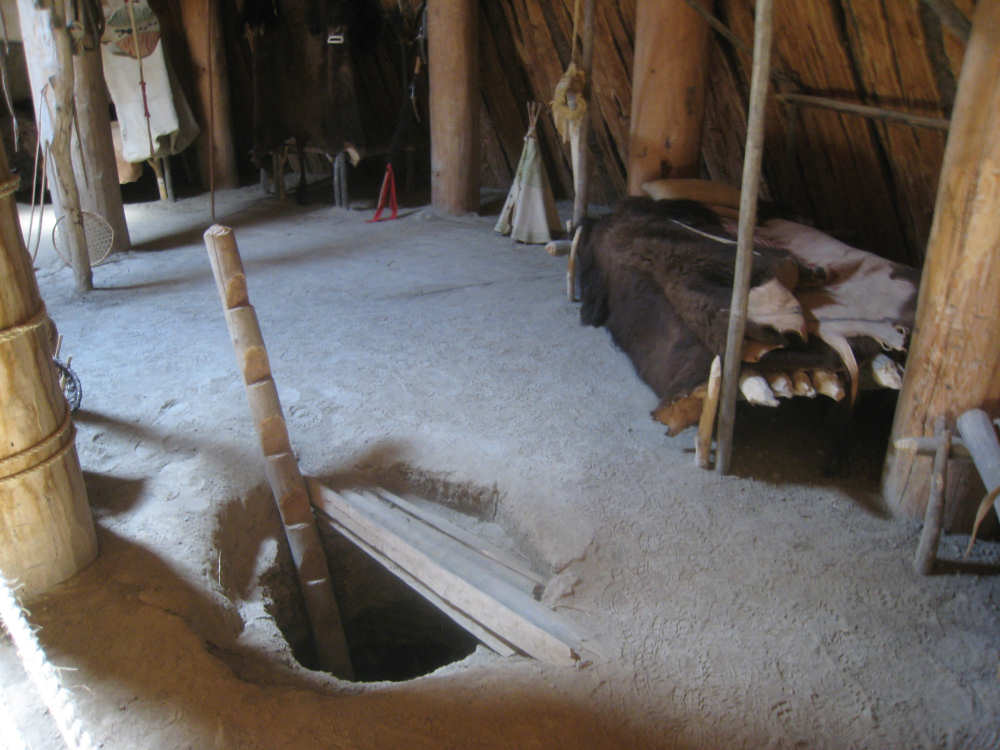
A root cellar and a bed by the wall |
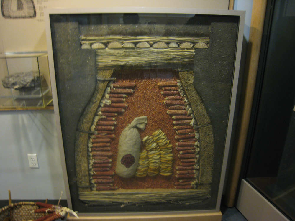
A schematic of the root cellars dug into the earth in and around the lodges |
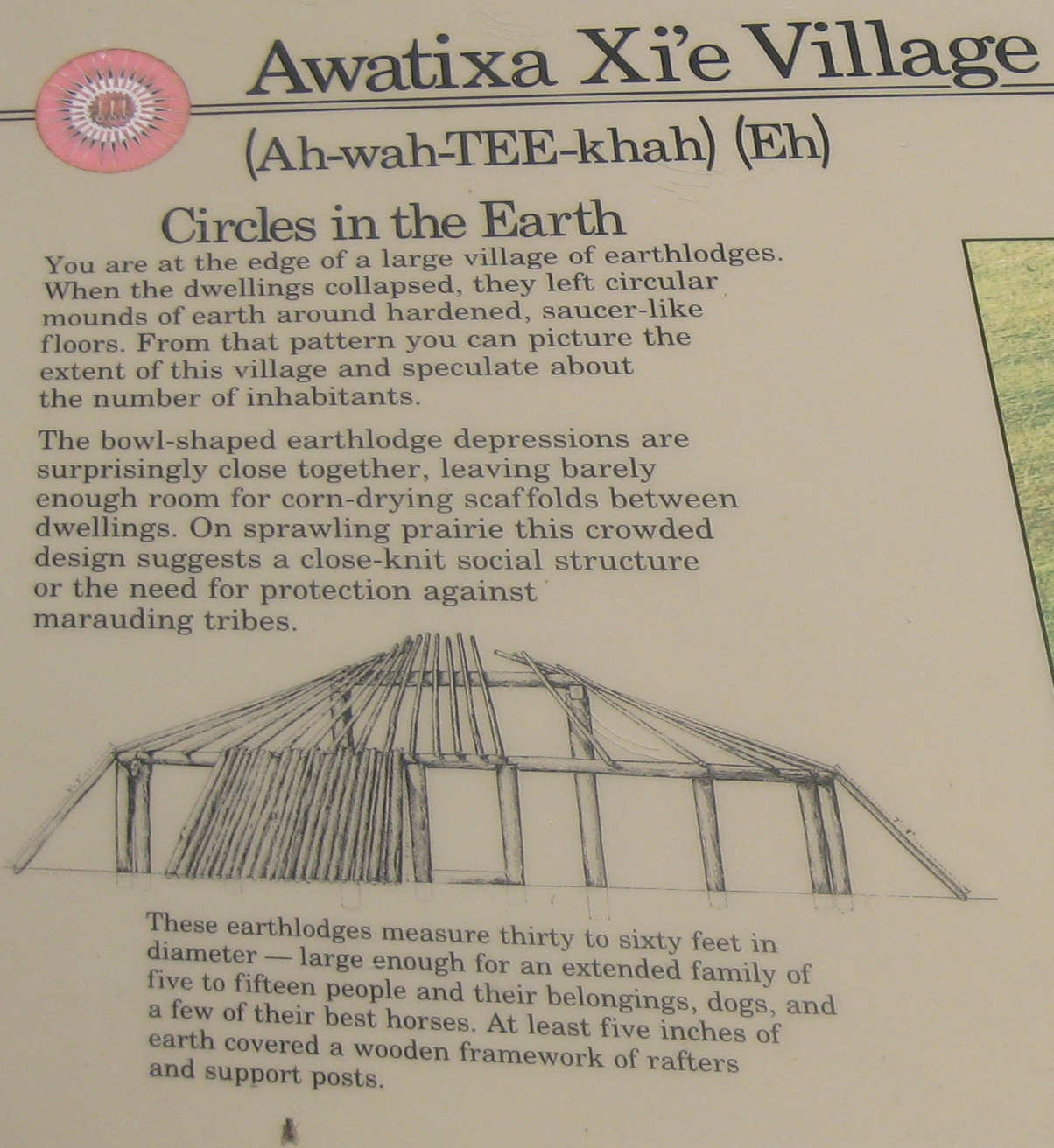
Another description of an earthlodge village... |
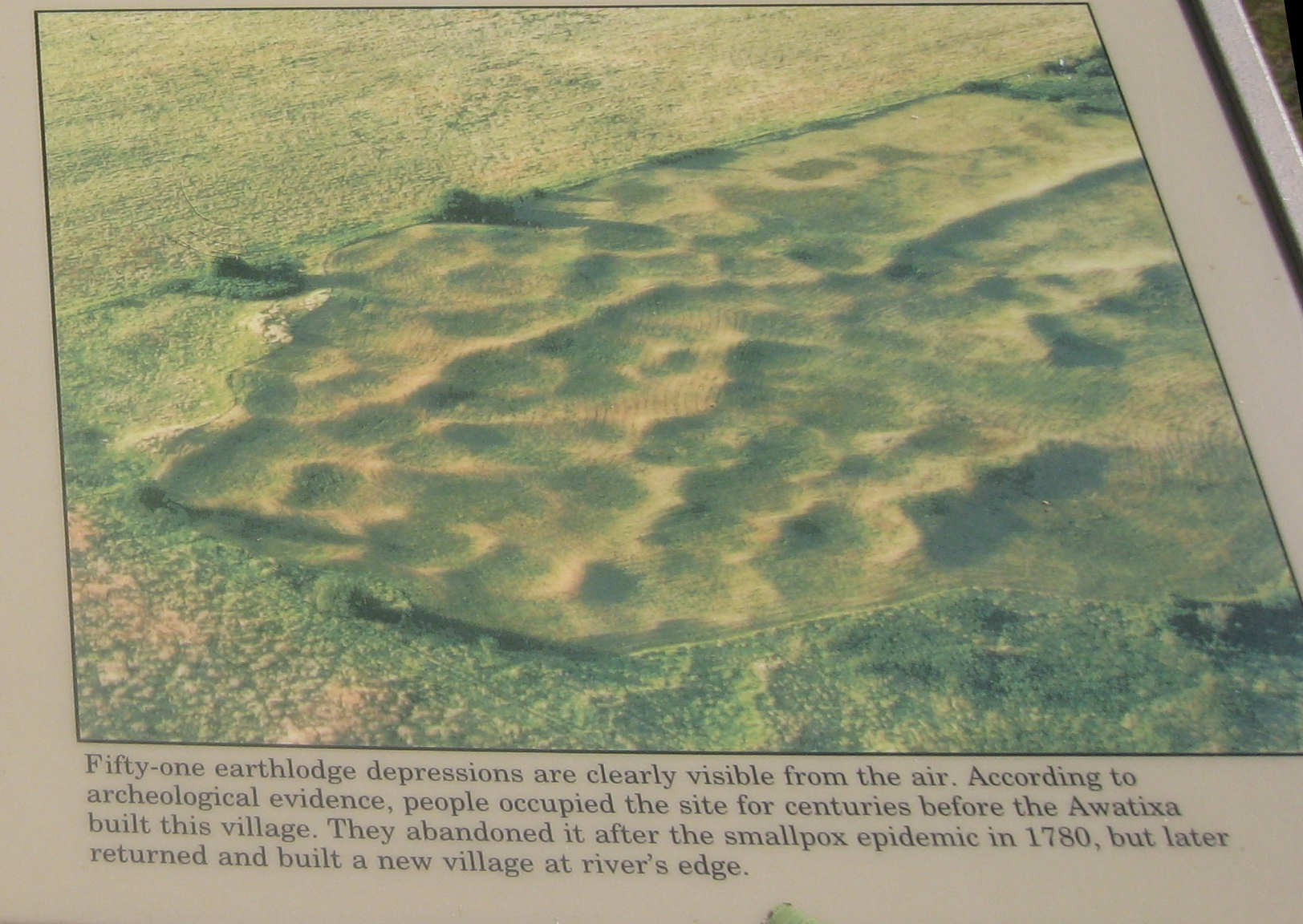
and an aerial picture of the area today |
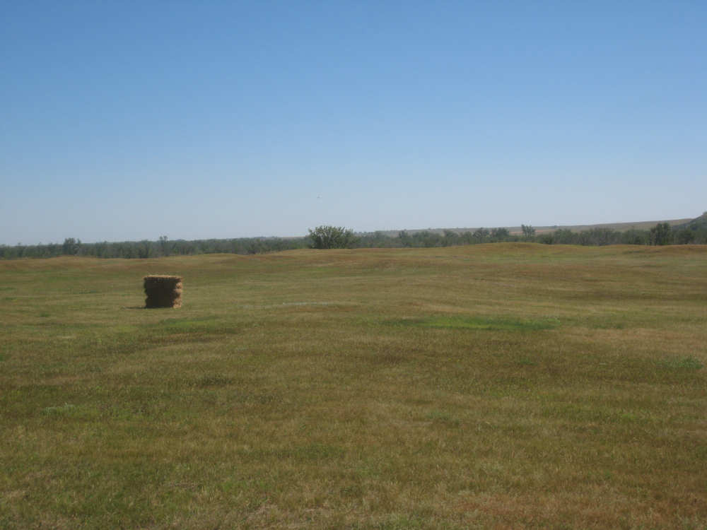
This is what the area looks like from the ground |
Knife River is just beyond the trees |
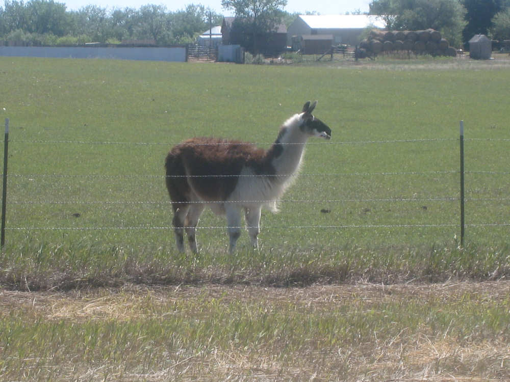
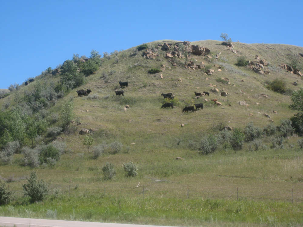
A nearby herd of cattle and horses also had this llama |
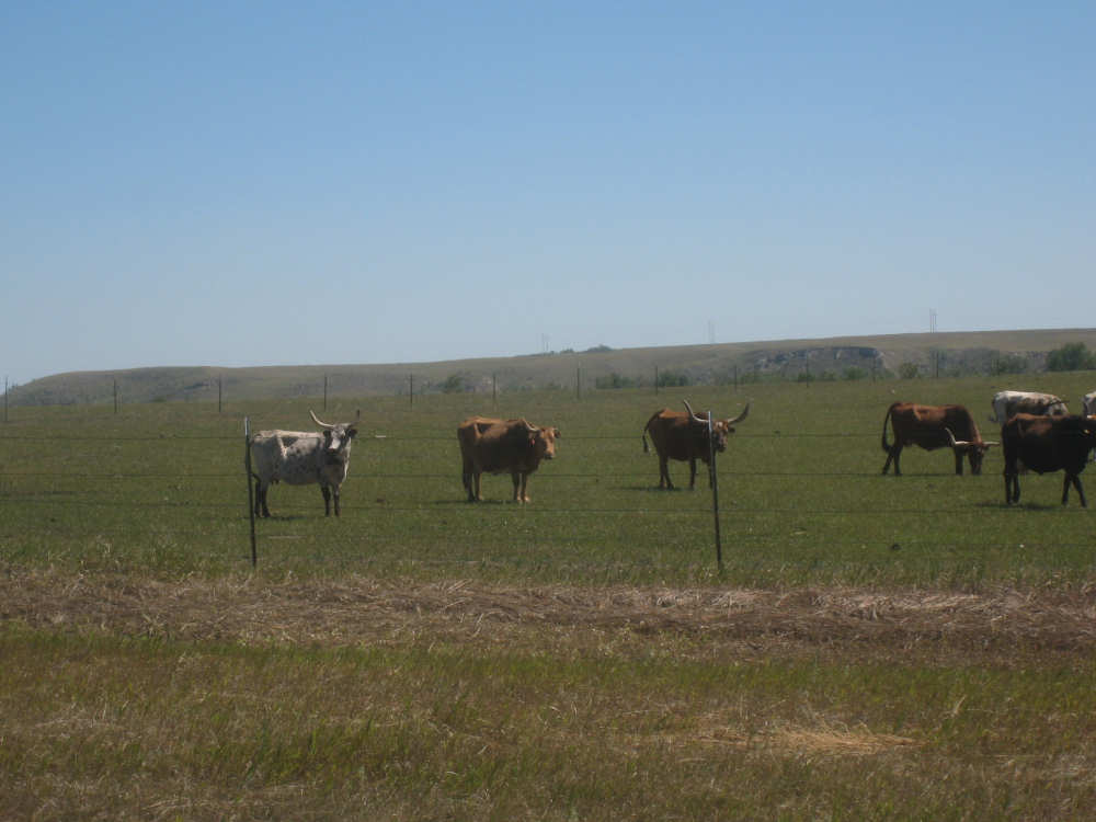
And these long-horn steer |

Approaching the Missouri River, below the far hills and line of trees |

An incredible sight |
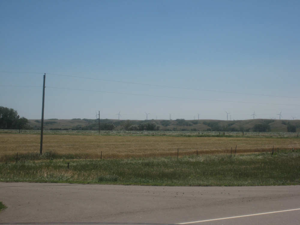
A line of windmills just past the hills |
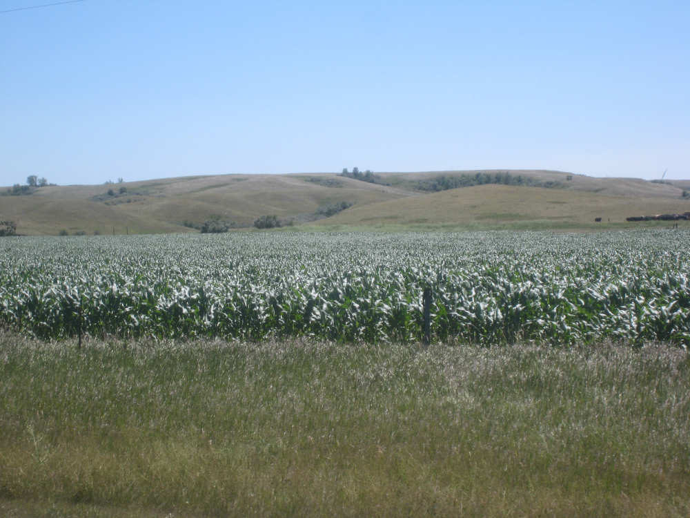
Large cornfields in the flat area below these rolling hills |
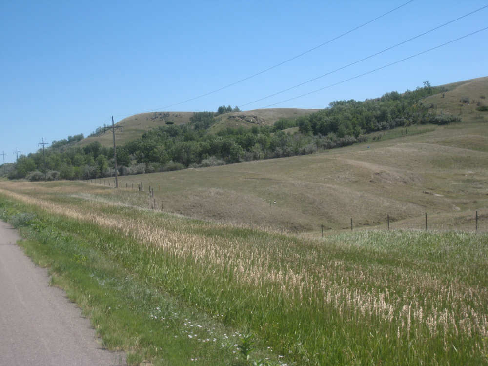
More rolling hills and trees as we approach the river |
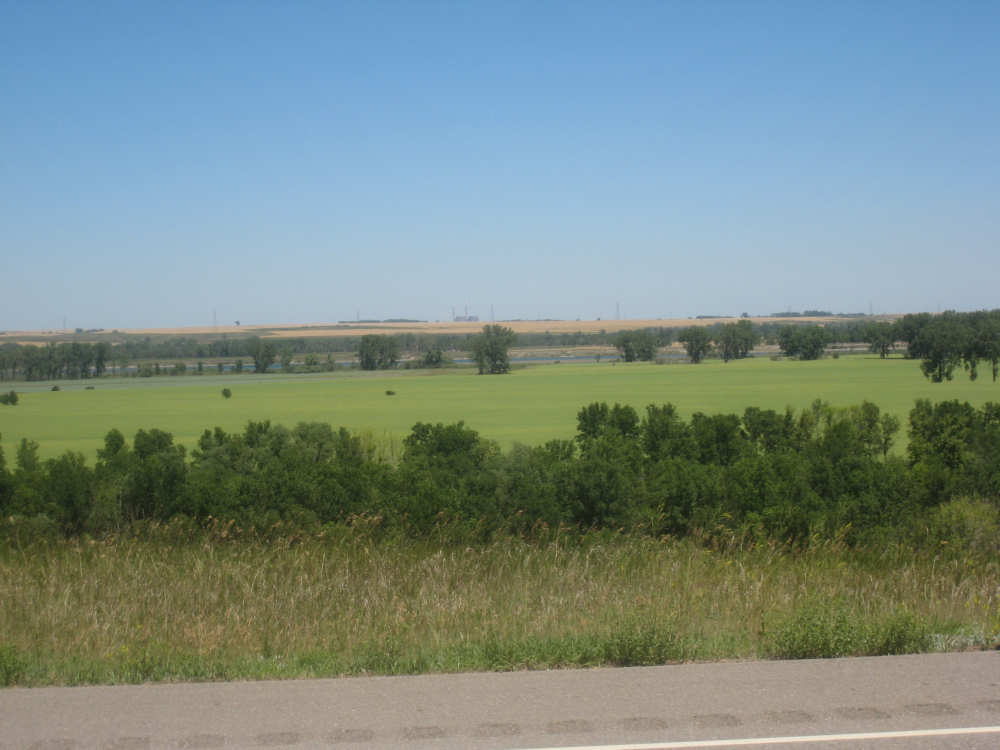
A fertile valley with a glimpse of the river beyond it |

Beautiful Mandan Lake |

|
The Missouri River to our left |
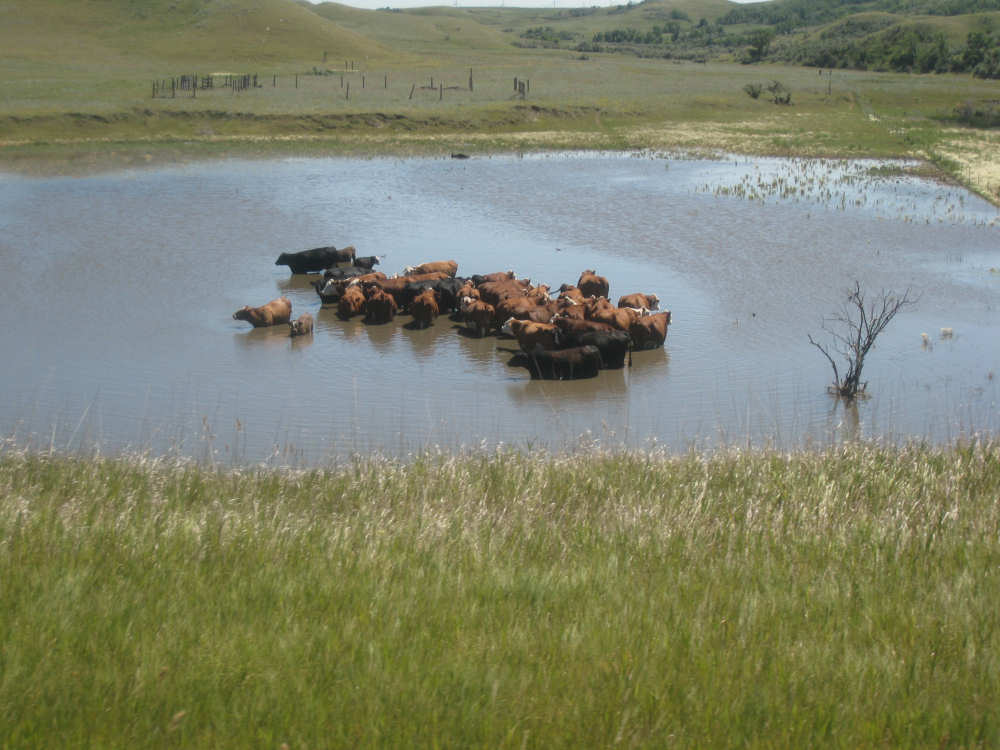
An intrepid herd of cows to our right |
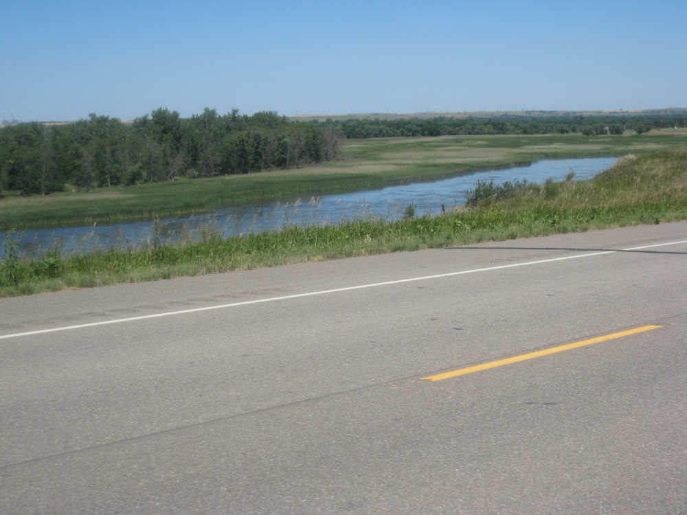
Wetlands next to the river |
Ahhhh... |
These cows seem to be too scared to dive in |
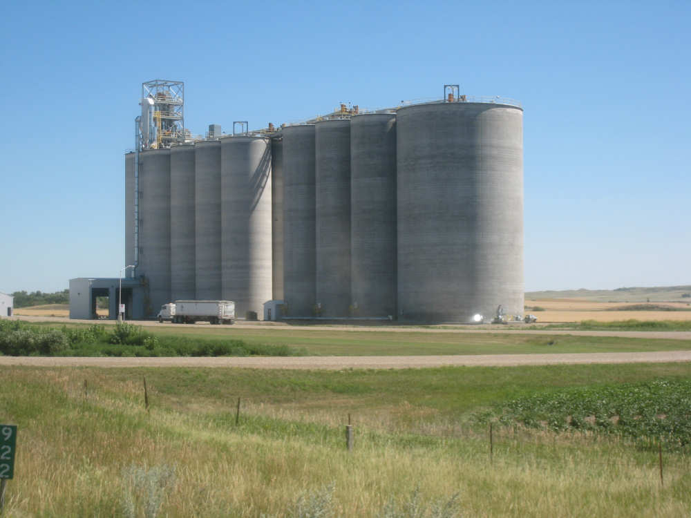
Giant cement grain silos near the tiny town of Hensler |
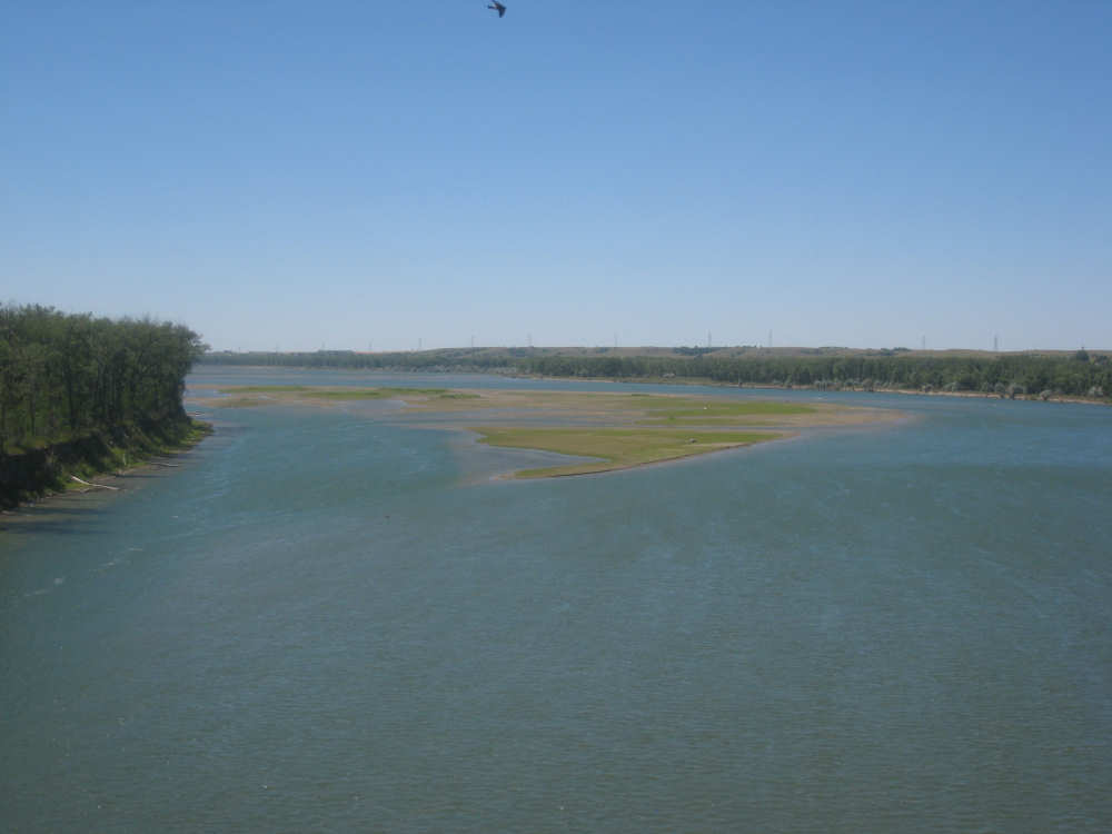
Crossing the Missouri - this is upstream... |
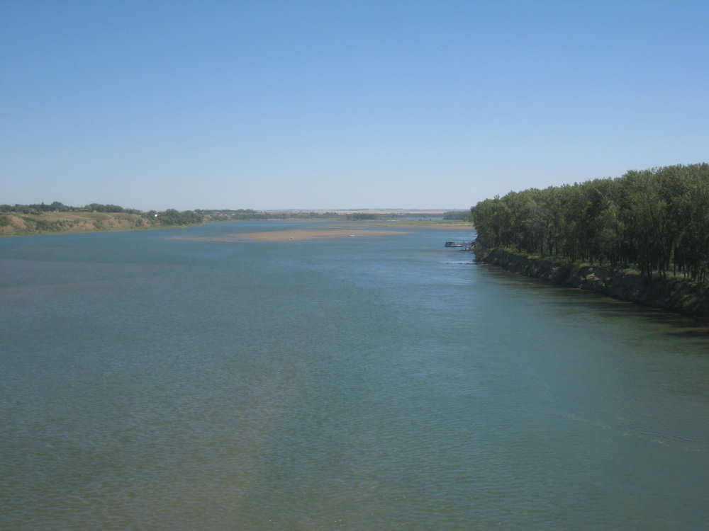
and this is downstream |
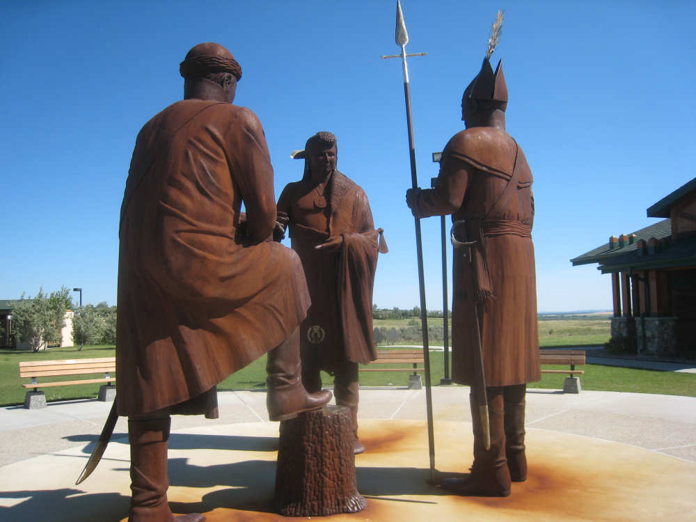
The giant statues outside the Lewis & Clark Interpretive Center |
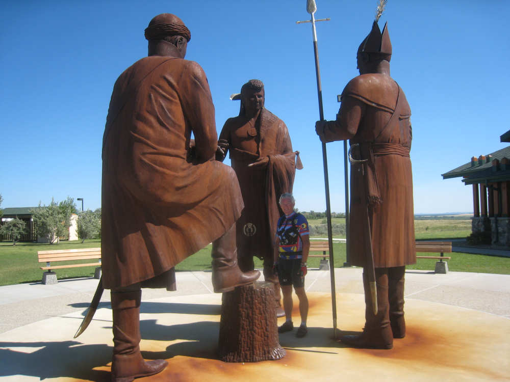
Pat infiltrates the meeting to show a sense of scale |

A herd of buffalo outside the center, with names of donors on some of them |
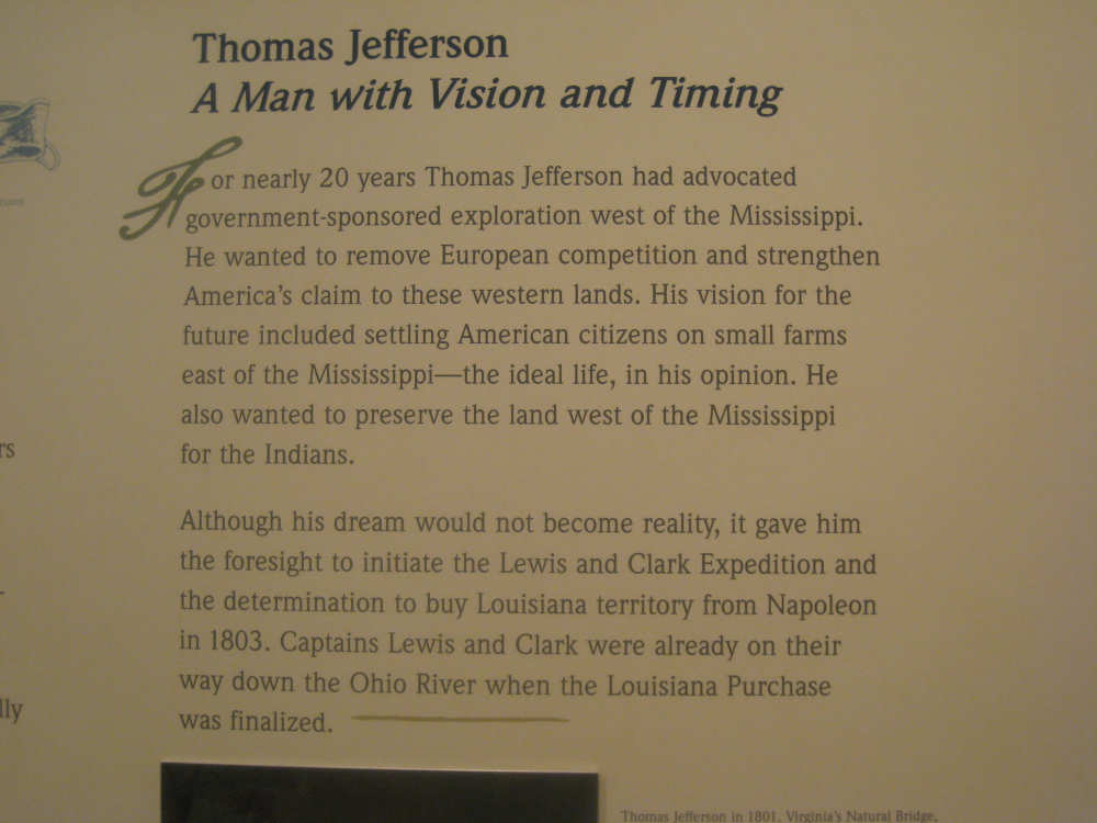
A writeup about Jefferson inside the center |
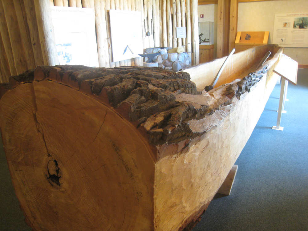
A cottonwood log being transformed into a canoe |