Sunday, July 06, 2008
Kooskia, ID to Lowell, ID
49 miles (5715 total miles)
We started out at 6:30 after breakfast, expecting a long, hard day with lots of climb. It turned out our Street Atlas had greatly overestimated the amount of uphill today and we had a very gentle climb with lots of level and a few slightly downhill stretches. Maybe it was just that the beauty of the rivers we rode by all day distracted us from the effort, but today seemed one of the easiest days we've had in a long time. More about the rivers in a bit.
Today was a very social day as well - we met a total of 6 bikers, all riding west on the Trans-Am trail or a modified Trans-Am/Lewis & Clark trail. The first one was Jeff, a retired air force guy from England. We met him early in the morning and spent a lot of time afterwards trying to figure out how he got as far as he had so early. He asked us about the long spell in Washington without services and we easily convinced him he should go on the Oregon side as we had. He seemed much relieved to hear that that was a workable solution. Then we met two guys from North Carolina, Marc and Russ who were traveling separately but had met up on the road. Russ was riding with his family who were driving a support van for him; they were raising money for a Durham Children's Hospital. The next two were a couple from Virginia, Diane and Wayne, and the sixth was a friend of theirs from Holland, whose name was something like Meno. He rode a recumbent and had a cracked rim on his rear tire so he was running behind his two friends. We had to tell him our cracked rim in Tempe, AZ story, of course.
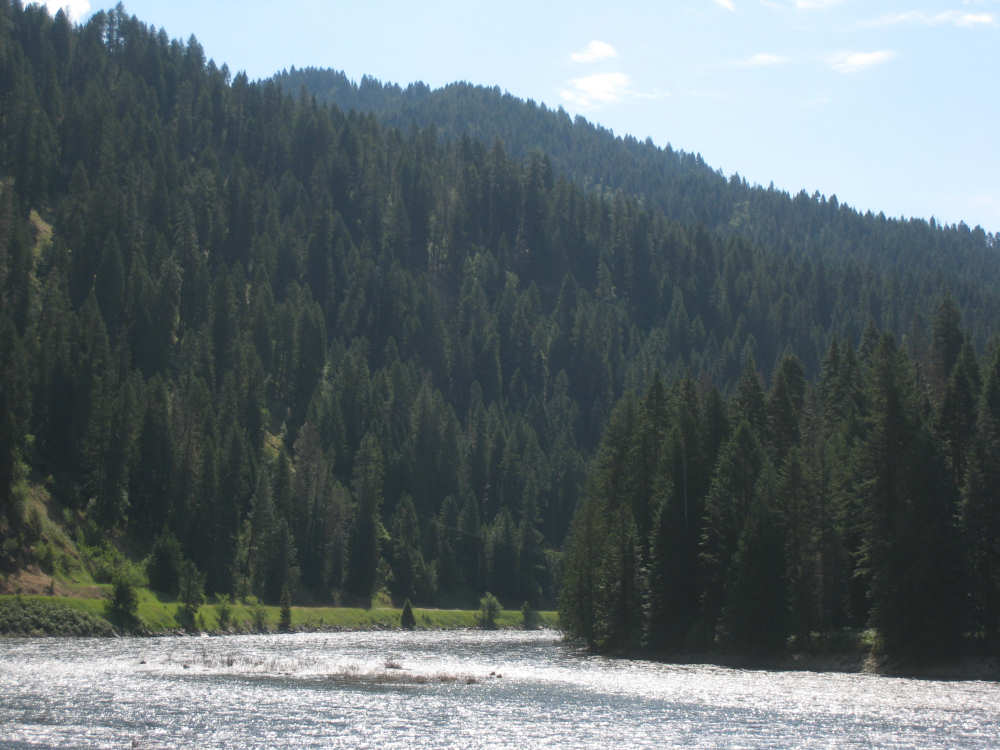
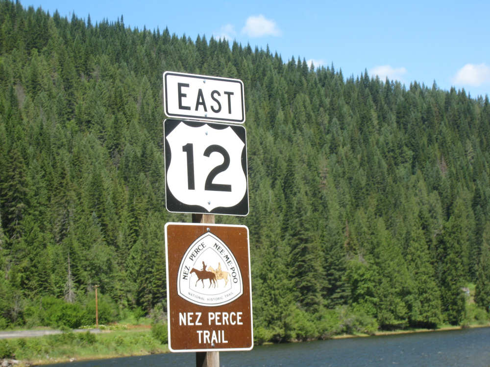
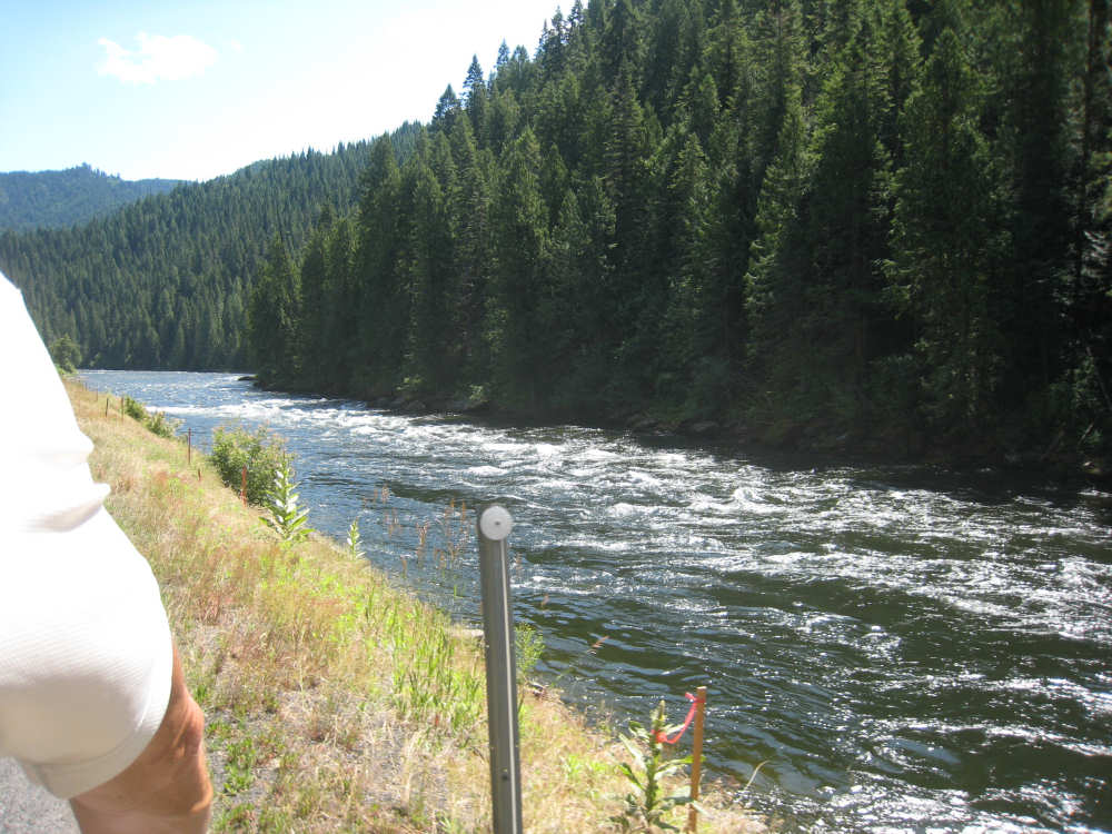
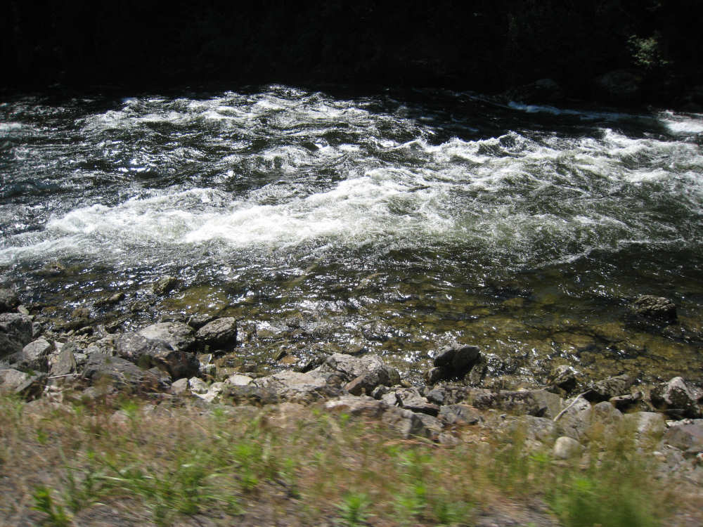
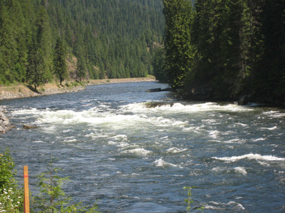
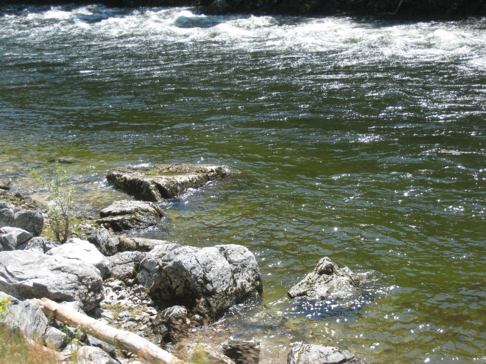
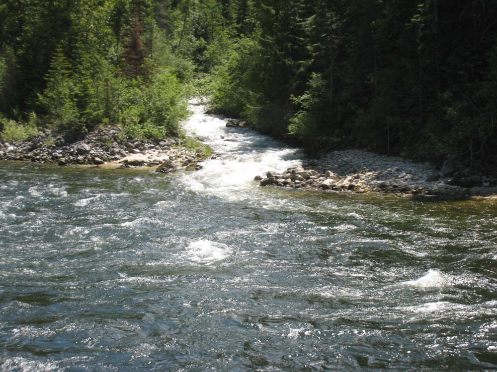
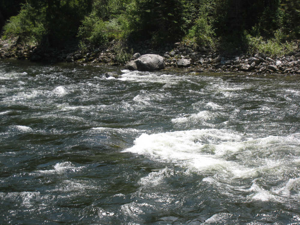
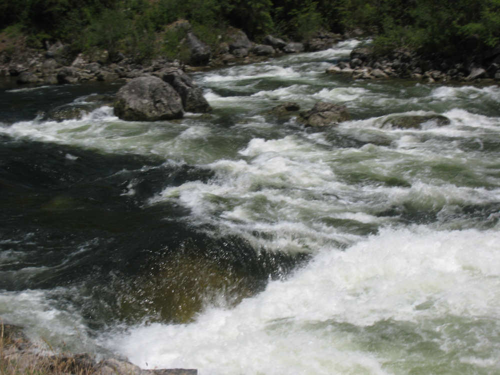
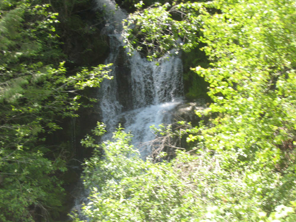
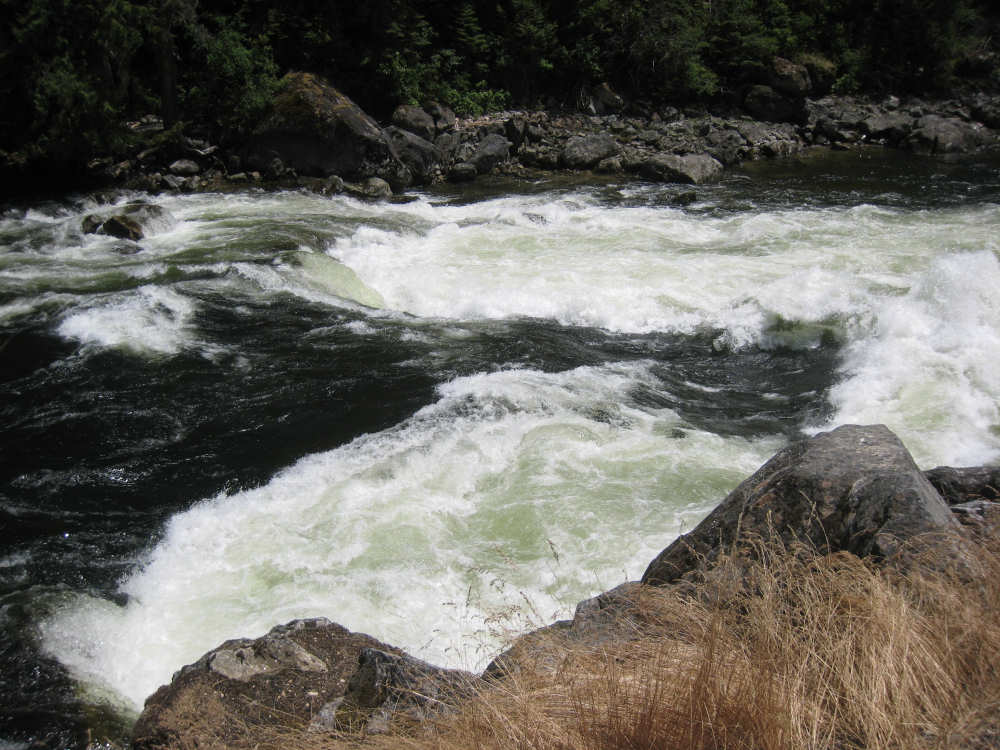
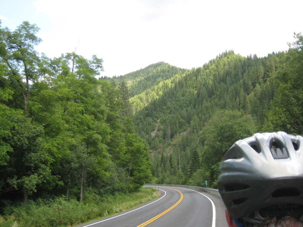
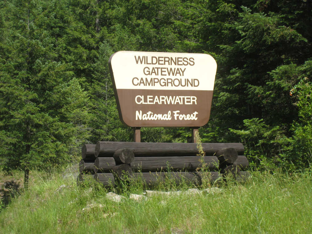
We left Kooskia and the brown hills we had gotten so fond of, turning on Rt. 12 again, where we were all day and will be until we hit Missoula. We were happy to see the Clearwater River again, the Middle Fork of it to be exact, running as fast and beautiful as ever. As we went upstream, it developed more and more rapids from time to time. We left the Nez Perce Reservation at some point early in the day and entered the Clearwater National Forest. Kooskia had promised to be the gateway to Idaho's wilderness, and that was just what we were entering today. The hills around us were covered with evergreens of various types and the hills themselves got taller and taller as we headed east. The towns also got fewer and fewer. We passed two today, Syringa and Lowell, both very small and tourist-oriented. Rafting and kayaking rentals and tour guides were the main sources of income here, besides vacation cottage rentals. There were very few bridges across the river (mostly because there was nowhere to go on the other side), but we did see some contraptions that looked like zip lines across the water. There was also one private bridge at the town of Syringa. Later in the day we came to something called a pack bridge, which was basically a walking bridge across the river for those who wanted to hike the trails in the wilderness area on the other side. We reached the confluence of the Selway and Lochsa Rivers sometime after Lowell - together they formed the Middle Fork of the Clearwater - and followed the Lochsa River from then on. The Lochsa started out looking much like the Clearwater, but got wilder and more turbulent as we continued upstream. There were several exciting rapids and rushing streams from the south side of the river (to our right) came gushing in to join the river from time to time; water flowing down the hills to our left also joined the river through pipes under the road. After a point, we started to see some kayaks and rafts coming down the river - it was fun to watch the kayaks riding back and forth through the rapids like surfers and the rafts crash through like bronco riders.
We eventually came to the edge of the Selway-Bitterroot Wilderness area, which is one million acres with nothing in it but trees and other flora, wildlife and a few hiking trails. The most famous of these trails is the Lolo Trail, the trail Lewis & Clark's party took over the Bitterroot Mountains - way beyond our capabilities, we're sticking to the low road. The historic marker has a quote from Lewis' journal at this point, one of the most difficult of the entire journey, during which they were close to starving. We also like the quote our friend, Terry from Tempe sent us from Lewis' journal - September 14, 1805 (Camped on the Lochsa River, Idaho County, Idaho, near Powell Ranger Station- White Sand Creek): "here we wer compelled to kill a colt for our men & Selves to eat for a want of meat & we named the South fork Colt Killed Creek and this river we call Flathead River. The mountains which we passed to day much worst than yesterday the last excessively bad & thickly strowed with falling timber & Pine Spruc fur". Although we're skipping the difficult trail they followed along the ridge of the mountains, we will have to cross the peak at Lolo Pass before we can get into Montana. The Pass is at 5235 feet so we will have to do some climbing in the next two days. We ended today at around 2400 feet, having gone 49 miles in under 5-1/2 bike hours. It was a hot and sunny day but the cool air from the river cooled us down some; later in the day some big clouds developed that blocked the sun at times and gave us some much appreciated shade. All in all, it was a pleasant and beautiful day of riding.

Brown hills outside of Kooskia |
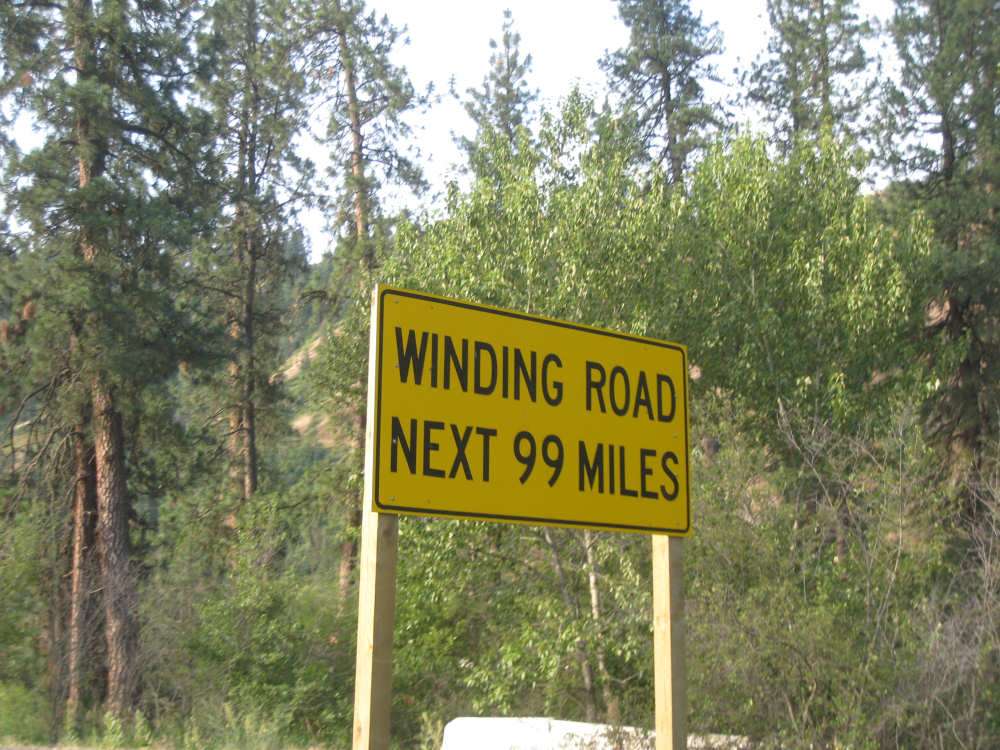
We had been warned - the road would be narrow and winding |

Another history lesson of our terrible treatment of peaceful tribes |
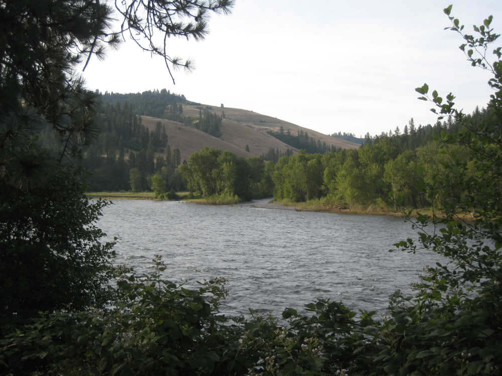
Back on the Middle Fork of the Clearwater River |
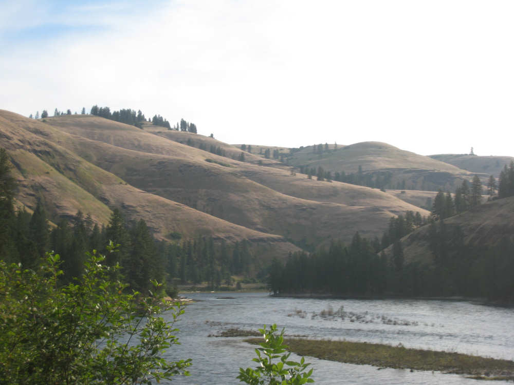
Our last view of the brown, barren hills |
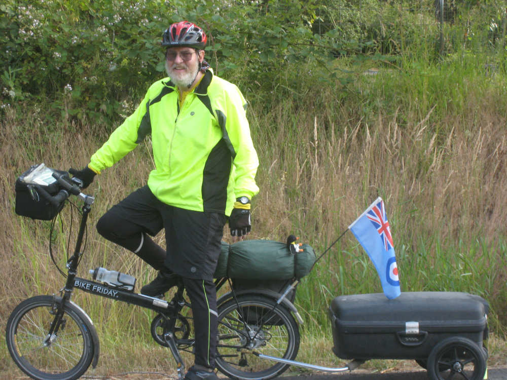
Jeff from England |
One of the zip line contraptions |
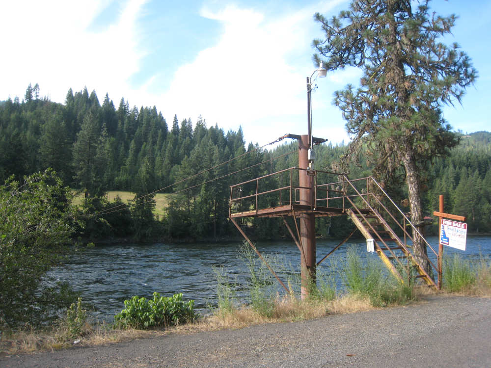
A better view of another zip line |
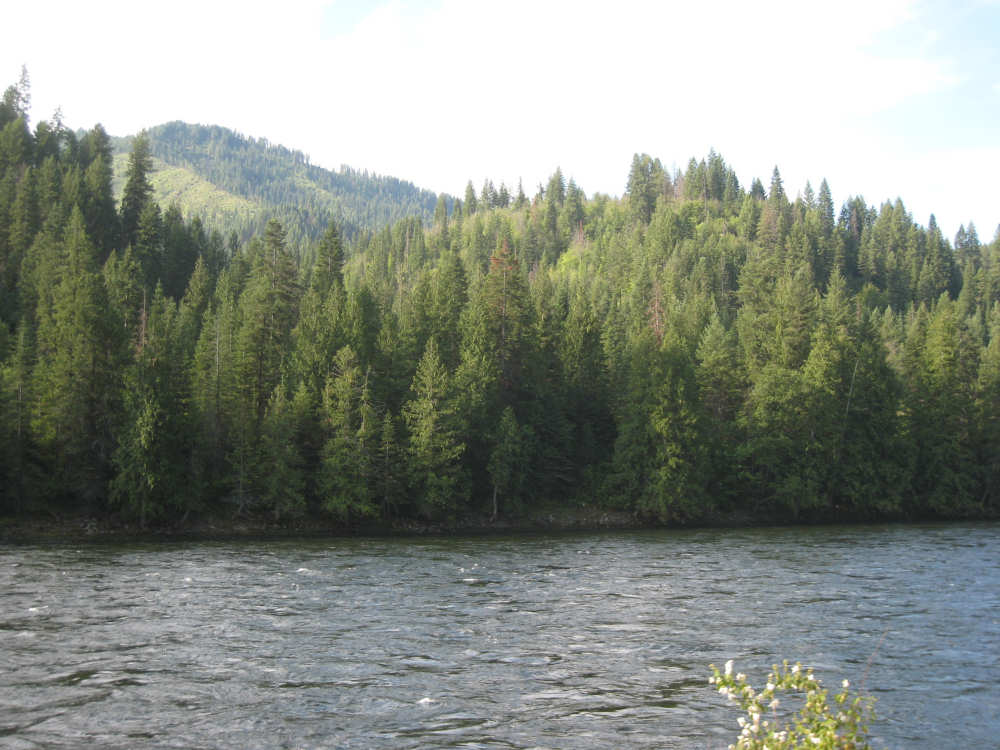
Forests cover the hills and line the river |
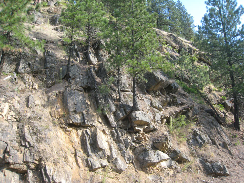
Rocky cliffs along the road |

The hills are getting taller as we near Syringa |

The private bridge across the river at Syringa |

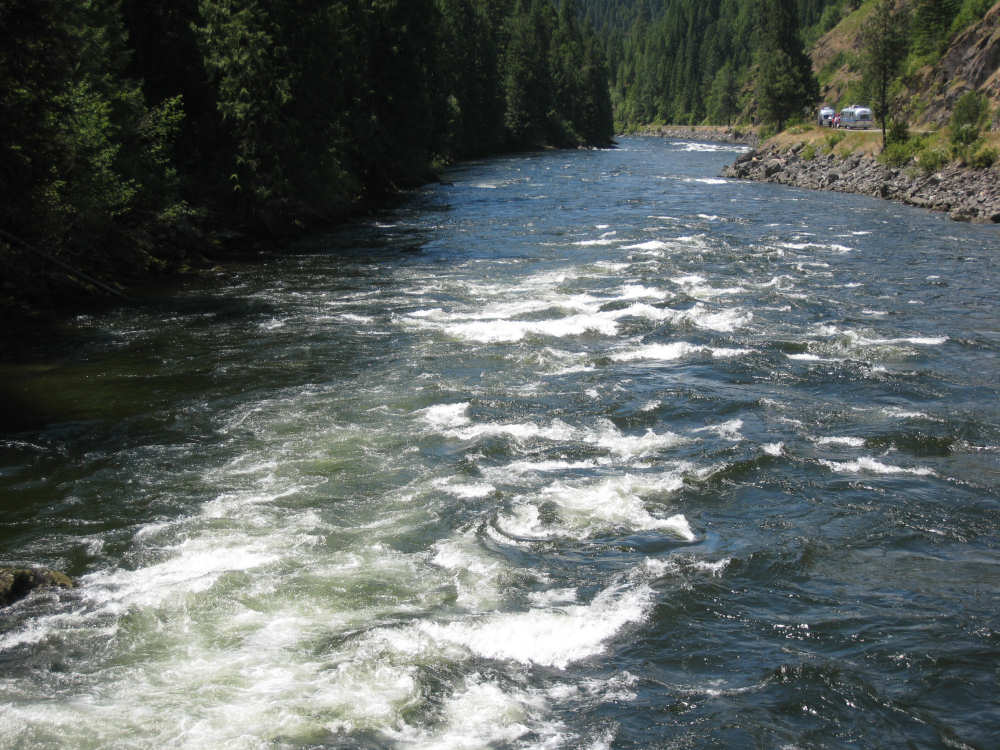
The waters get wilder |
The confluence of the Lochsa and Selway Rivers |
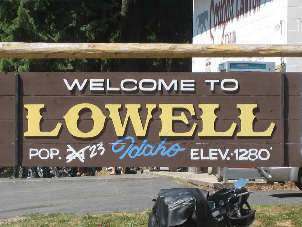
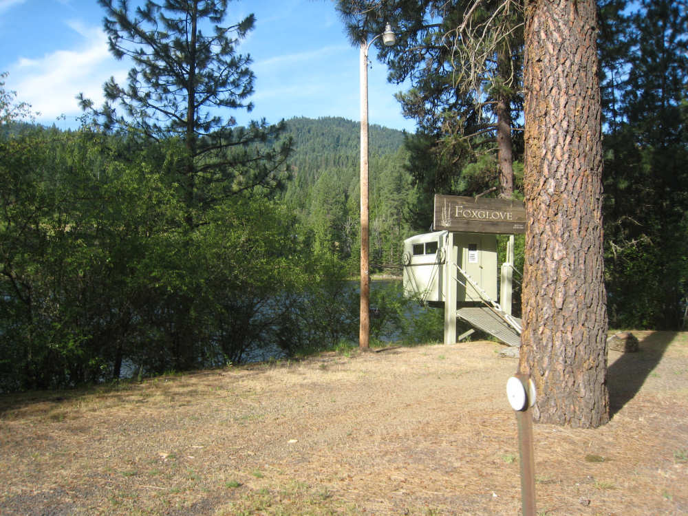
We arrive at Lowell - I guess someone recently died or moved away! |
Still on the trail |

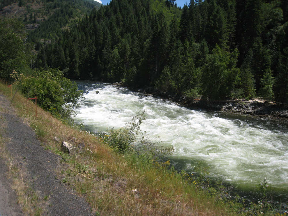
We're now following the Lochsa River |
The river delights us as we ride along it |
The water is very clear where it is calm |
A huge rock and a bend roil the river here |
Some of the rocks in the river look like they were formed by lava flows |
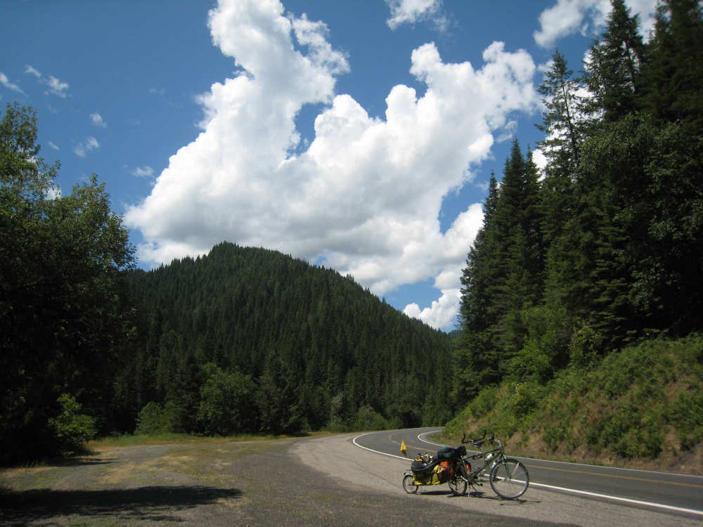
A huge cloud creeps up behind us |

Coolwater Creek rushes into the river from the side |
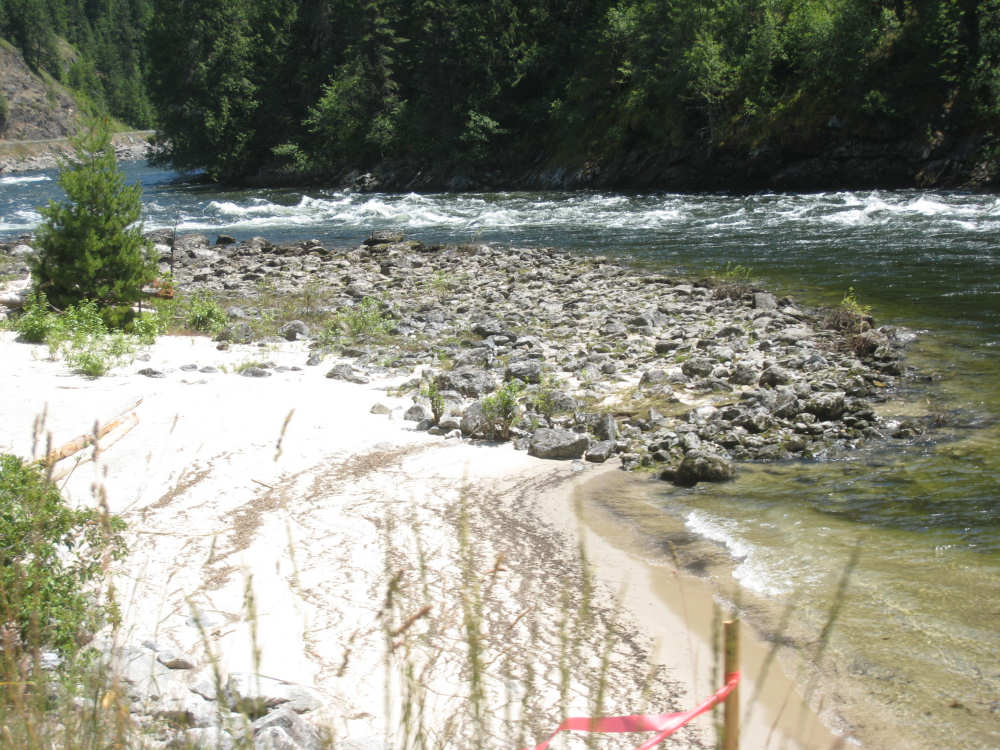
A rock bed and a sandy beach |
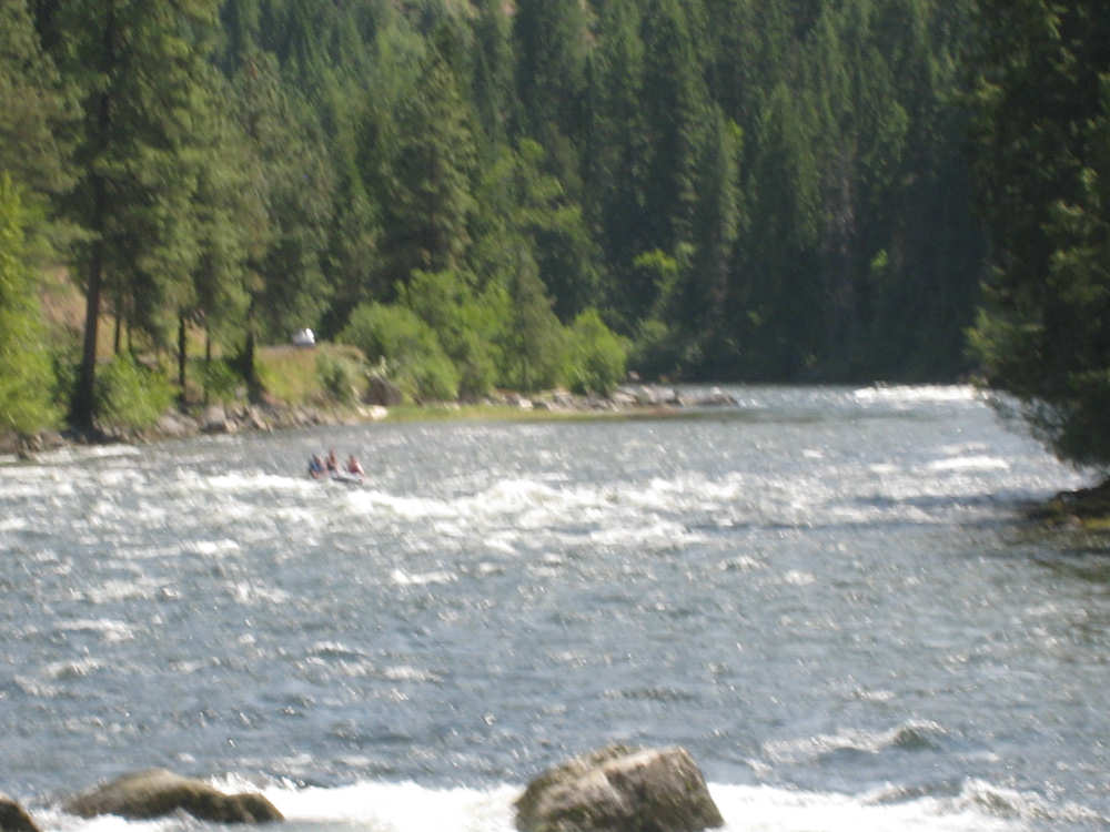
Rafters come bobbing down the waves |
Another creek coming in from the side |
A close-up of the churning water |
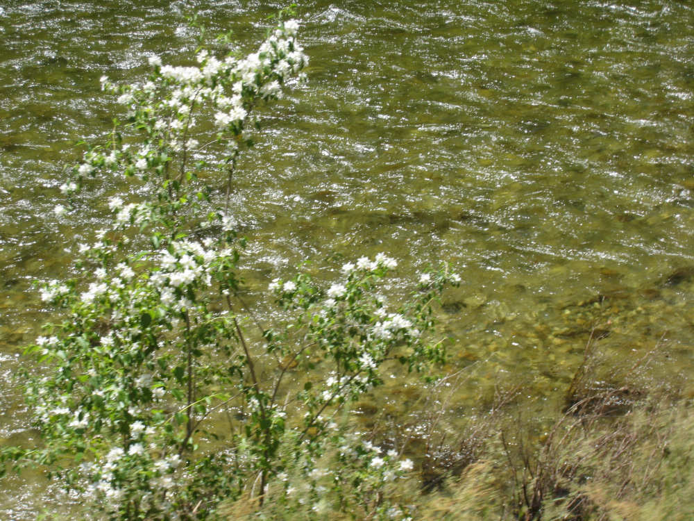
Flowers growing at the river's edge |
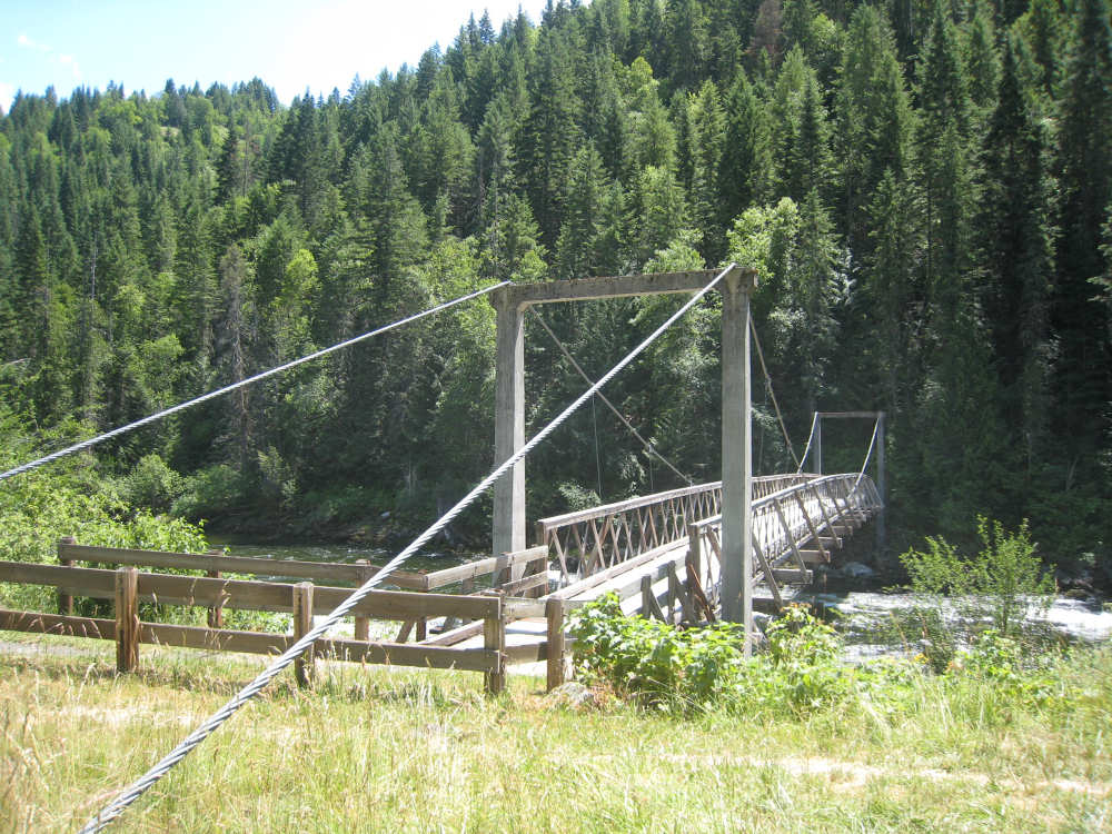
The Split Creek Pack Bridge - a walking bridge leading to trails on the other side |
The water under the bridge |
Another wild stretch of river |

Closer views of the wild water |
|
Water running down the mountain to our left - it will join the river, too |
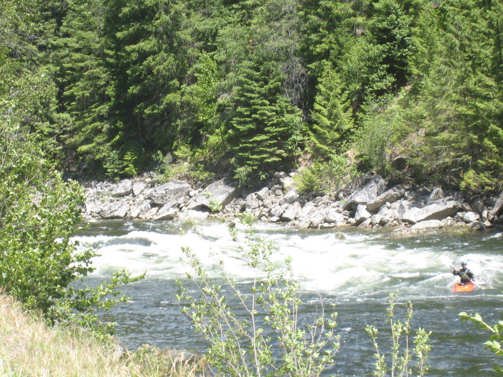
A kayaker comes through a set of rapids |
We watch another beautiful rapids... |
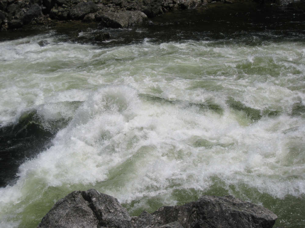
a close-up... |
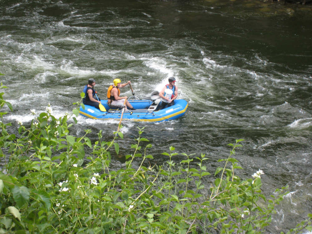
and some rafters come along (the guy in front is bailing water) |

Another fascinating rock cliff |
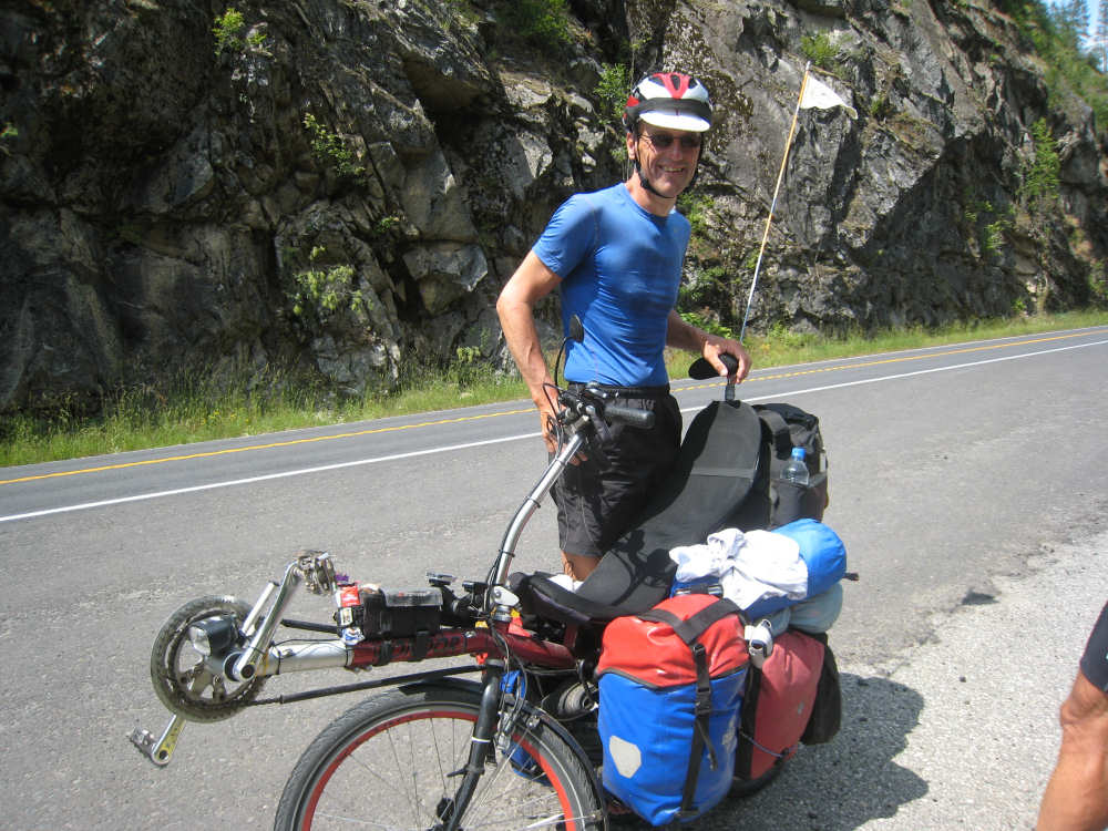
Meno (sp?) from Holland with his recumbent bike |
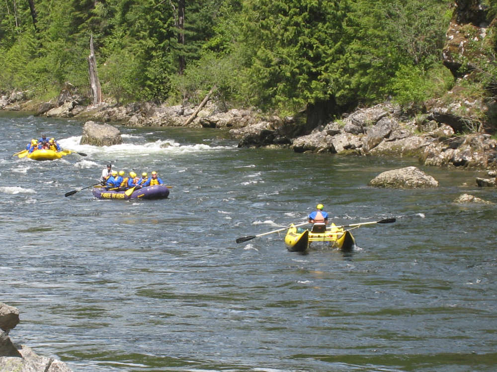
More rafters - the leader in a catamaran kayak in front |
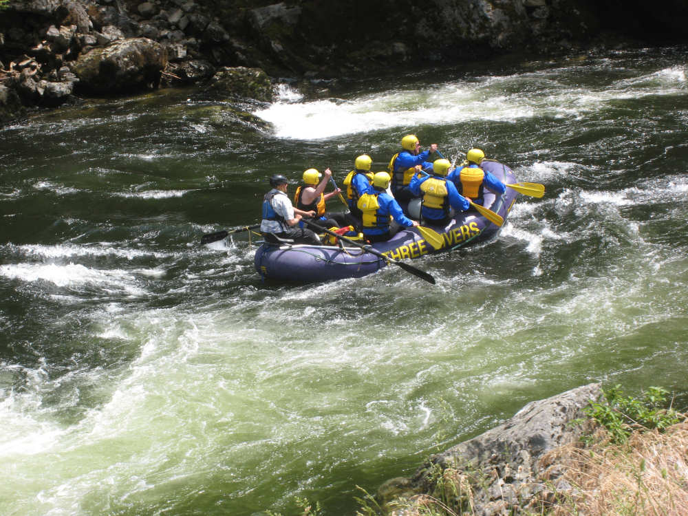
We watch this boatful paddle along |
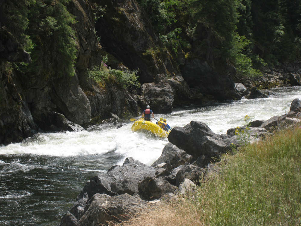
The guy in back comes to his feet as they buck through the rapids |
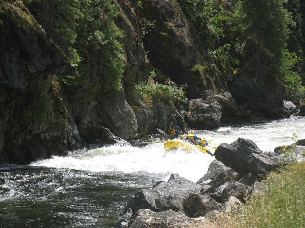
This raft also had a fun ride through |
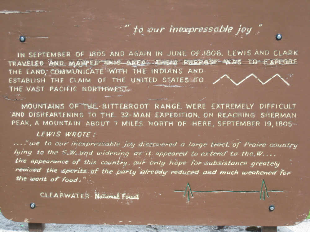
The Lewis quote - 5 days after the one we got from Terry |

The Selway-Bitterroot Wilderness plaque |
The mountains are looking very impressive |
We arrive at our campground... |
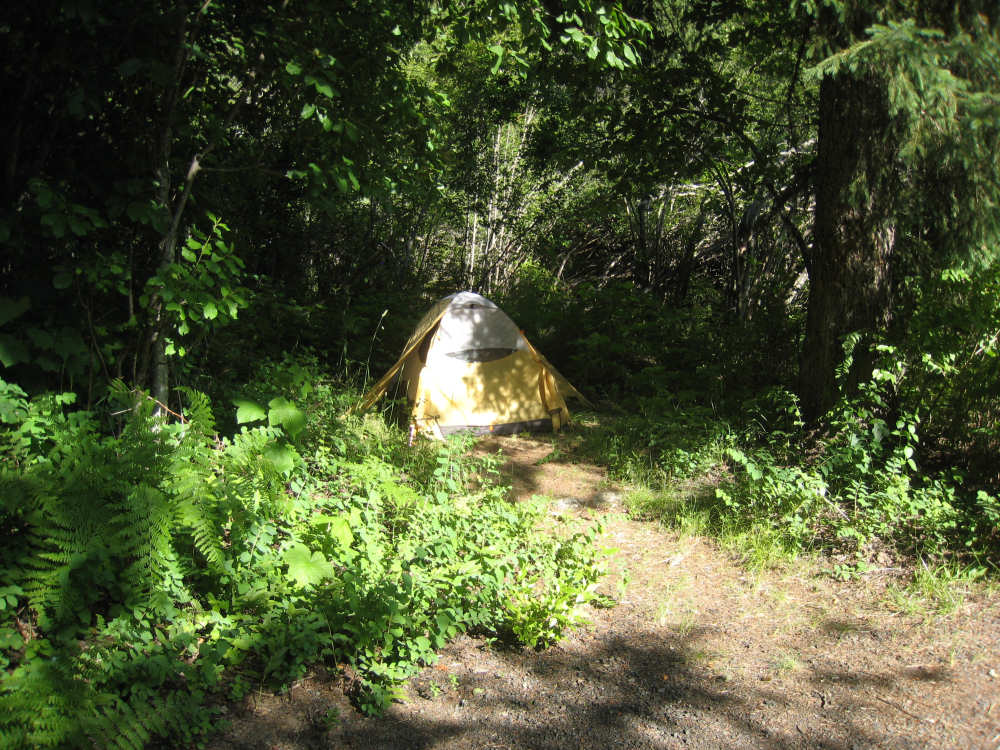
and set up our tent |
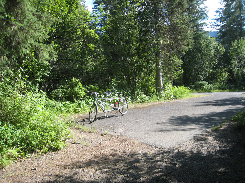
Our bike doesn't take up as much room as most of the other vehicles here |