Tuesday, July 15, 2008
Fort Benton, MT to Denton, MT
62 miles (6119 total miles)
Not much downhill and tail wind today, unfortunately. We knew we would have a longer day than we've had all week and more uphill than the last 2, but we didn't count on having a strong headwind for much of the day as well! The day was cloudy and cool this morning, and stayed that way all day. At one point we felt a couple of raindrops, and wondered whether to put the plastic bags on our un-waterproofed stuff, but it never came to that. We were glad for the cloud cover since it kept us cooler, and the wind helped in that regard as well but it also slowed us down a lot at times. There were a couple of stretches when we made a turn and got some tailwind for a while, so that helped some, especially when that happened near the end of the day when we were really ready to get to our motel and get off the bike.
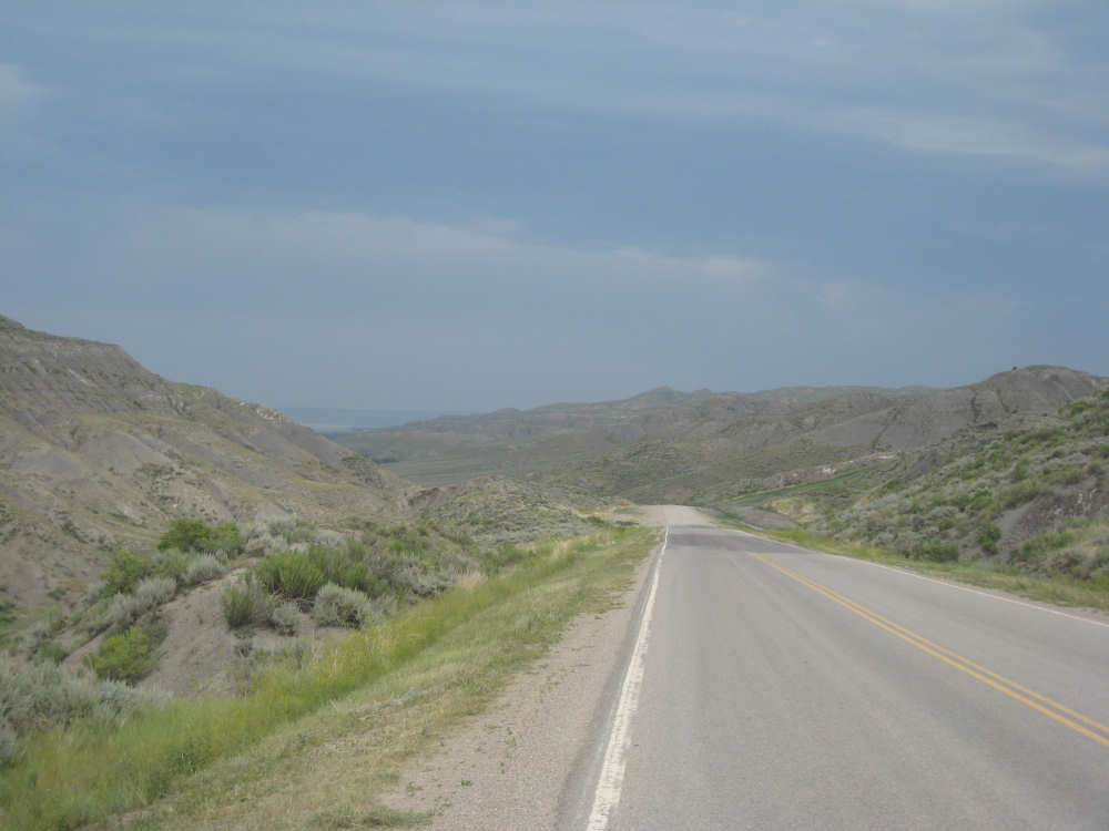
We had a later start than usual, as the hotel's breakfast didn't start until 7:30, but we had a nice chat with 2 couples staying at the hotel while we waited. One couple were land surveyors who were working in the area, the other were touring the area with a group. The morning hotel manager was very helpful, when she heard we were going to Denton she warned us about the big hill we would be going up. We already knew the hill was long and steep, but she also told us there were some rough stretches on it where it had loose gravel on the road. So we had even more to look forward to. We got off at 8:15 and headed across the Missouri on Rt. 80. We heard lots of birds chirping as we came to the bridge and soon saw a huge flock of swallows swooping in all directions over the water. We wished we could bring one or two of them with us to take care of the mosquitoes. We didn't have too much trouble with mosquitoes today, actually - maybe because of the strong wind - but we did have a few unfriendly encounters with some horseflies. The cliffs along the Missouri were beautiful; the hotel manager explained that there really wasn't any name for the high part of the land (what I've been trying to call mesas or buttes), that was just the land. The openings in the land, most notably where the river cut through it, were called the Breaks, as in the Missouri Breaks. So we climbed out of the Missouri Breaks this morning, soon after we crossed the bridge, our first big hill.
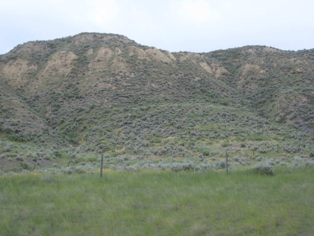
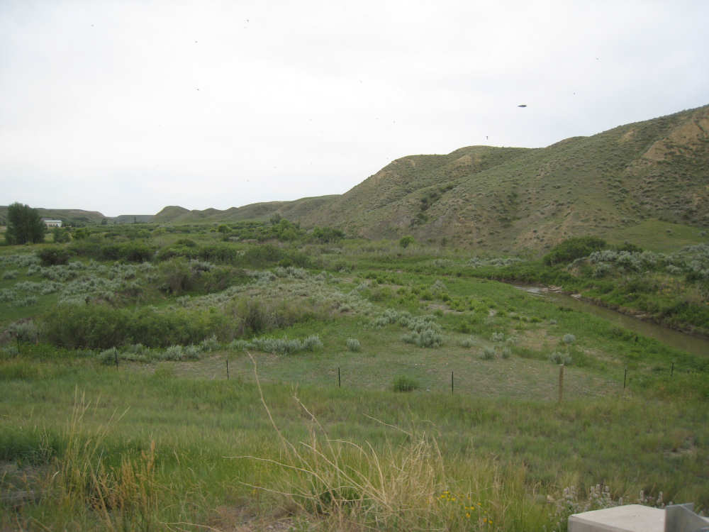
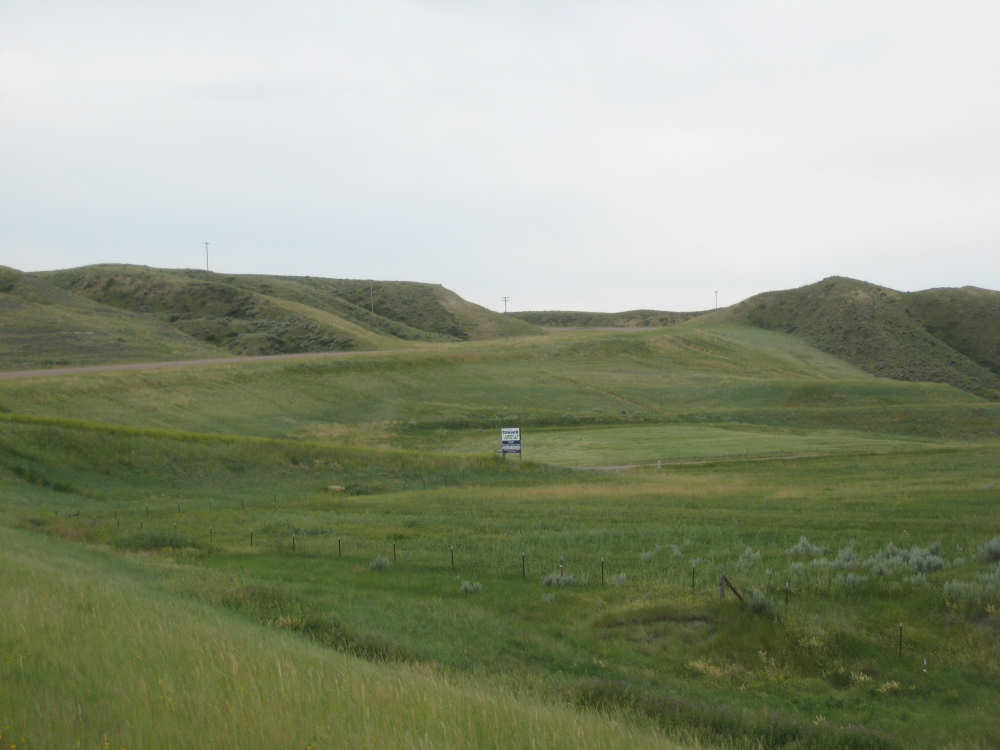
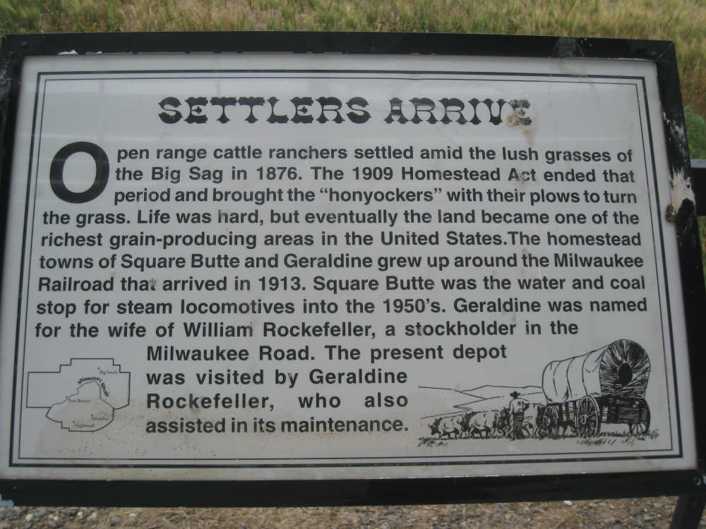
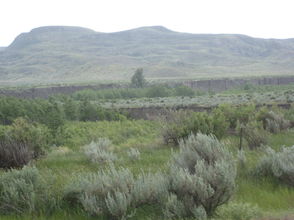
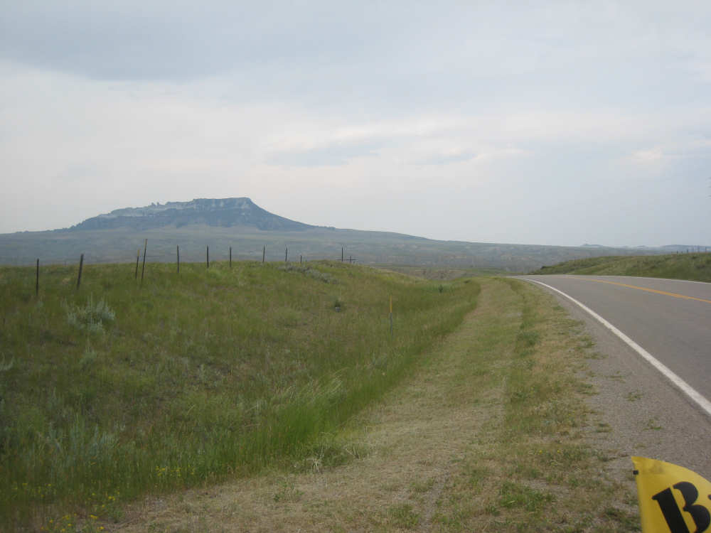
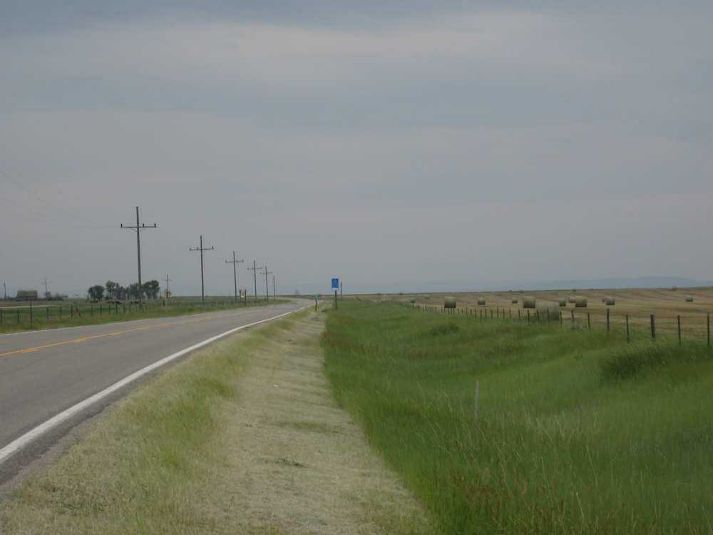
Once we got back up to the high land, we expected to see flat terrains and farm lands like we've seen the last 2 days. This area was quite different, though, it was more rolling and marked with many more ravines and gullies, more scrub brushes, and some interesting buttes and cliffs. We could still see the Highwood Mountains in the distance and had some plaques explaining their origins and the geology of the area. We saw a very large butte off in the distance before we saw the plaque describing it. This was Square Butte, which we passed today, as well as the small town with the same name. Our first and only significant town was Geraldine, about 26 miles from Fort Benton, where we stopped to eat lunch. The 2 land surveyors had passed us on the road early this morning; they had said they would be working in Geraldine and we had hoped to see them there at lunchtime, but we didn't see their truck anywhere. The restaurant/bar there turned out to be quite good and we had them pack us some sandwiches and goodies to eat on the road later. We went on, a little worried about how late we'd be getting to our motel, but the afternoon went a little better, with those few bouts of tailwind mixed in with the headwinds. The beautiful scenery helped take our mind off the hard work of pedaling.
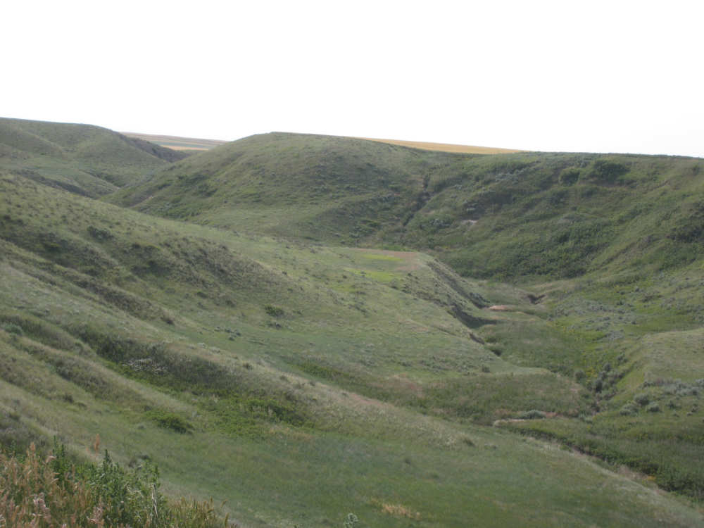
We finally approached Arrow Creek and the big hill of the day, catching a glimpse of our road winding up the hill (gulp!). First, we came to a viewing area which had a sign about the hill, which made it sound even worse than we had expected (thanks! just what we needed!). But off we went, gradually at first and then ever steeper, getting to 5-8% grades for most of the way. The wind was at least a bit calmer here, although we did have a few gusts now and then. Here again, though, the scenery was stupendous. The hills were fascinating and there were ditches cut deep into them at the edge of the road, where apparently a creek wound through. Some of the cliffs to our left had a strip of white stone in a layer near their tops. It may have been the same mineral that had left the dry lake beds that we had passed look white. At any rate, after after 2-1/2 miles of up, we got to the top! We celebrated by having the cinnamon rolls we bought in Geraldine and took pictures of where we had been. The top here was pretty flat and covered with wheat fields, much like our last 2 days had looked. We still had about 16 miles left to Denton, our stop for the night, but they went a lot more easily. We arrived in Denton at 5:30, earlier than we had expected. We had done almost 62 miles in almost 7 hours of bike time.
We found the motel in Denton, which was completely deserted at the time, and sat eating our sandwiches while we waited for the manager to arrive. We have to tell you the story of how we found this motel. It had been listed in our Adventure Cycling maps but the phone number it gave was disconnected. We tried getting the phone number online and through directory assistance, but the only number we found was the same discontinued one. We called the public library in Denton and the woman there said, yes, there was a motel there but she didn't have the number. She couldn't find the manager's number, although she said her name was Wanda, but she gave me the owner's number. I called and left a message but didn't get a call back. Things were looking bleak. When we were in Fort Benton, though, in our friendly restaurant (Bob's Riverfront Restaurant), the owner/cook said he used to live in Denton and his mother still did. So he called his mom and his mom called back a while later with the name and phone number of the motel manager. And the manager answered the phone! This was the third time we had gotten a motel room by happaening to ask the right person. We do have an internet connection here, but the connection is very slow and we're pretty tired. We have the pictures and the blog up but no captions yet, and we don't have the full-size pictures up yet either. How about we finish up tomorrow?
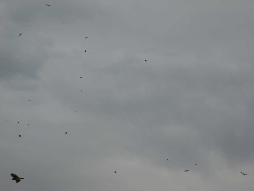
A swarm of swallows next to the Missouri River bridge |
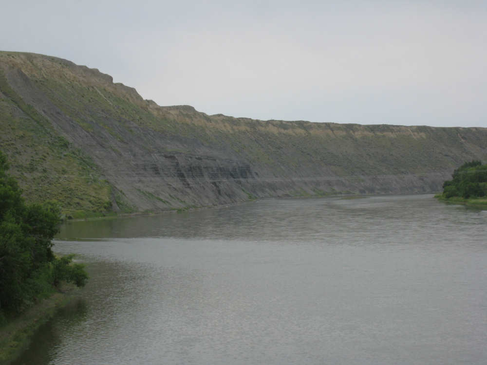
The land runs right down to the river in the Missouri Breaks |
Interesting hillsides as we leave Fort Benton |
A little valley with a house and farm tucked into it |
A view of the climb out of Fort Benton |
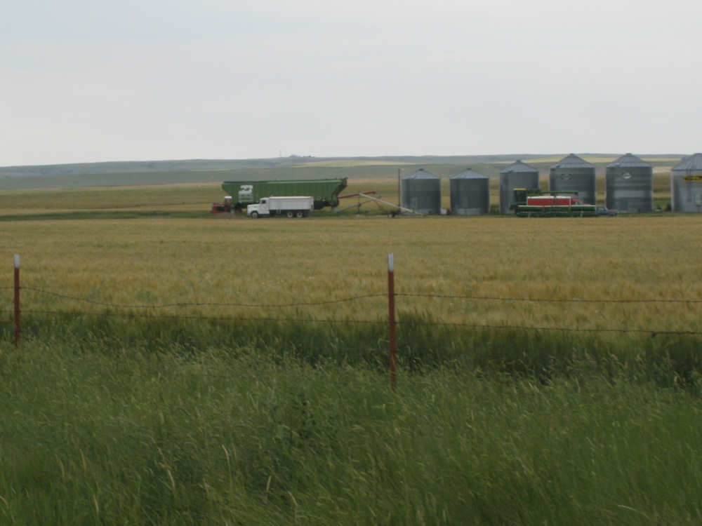
At the top again - fields and grain silos |
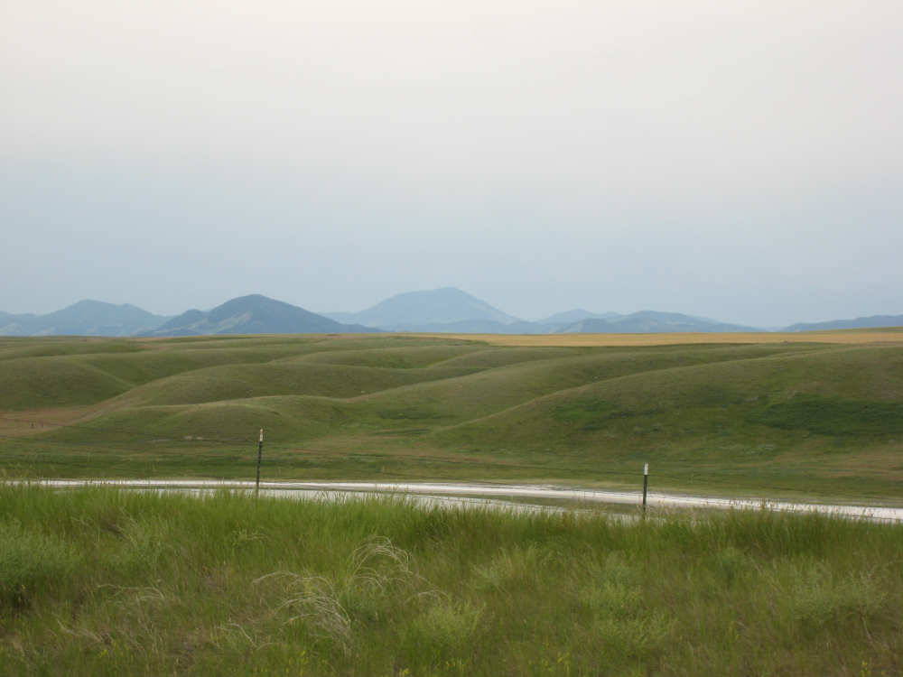
Not all is flat, though - some interesting undulations in the land |
|

|
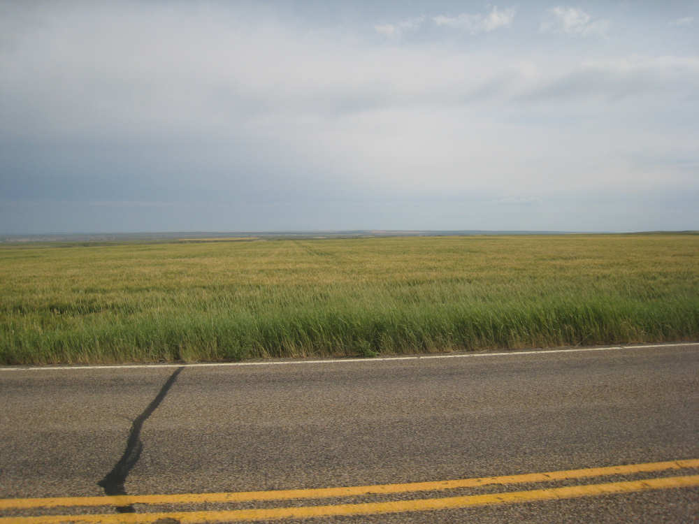
But the grain fields go on forever |
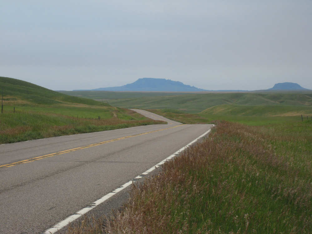
A large butte appears in the distance |
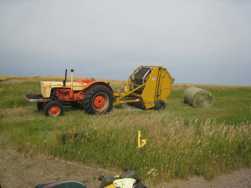
A hay baler left by the road where we took a break - note the BOB flag |
More bumps appear in the distance and an almost dry lake in the foreground |
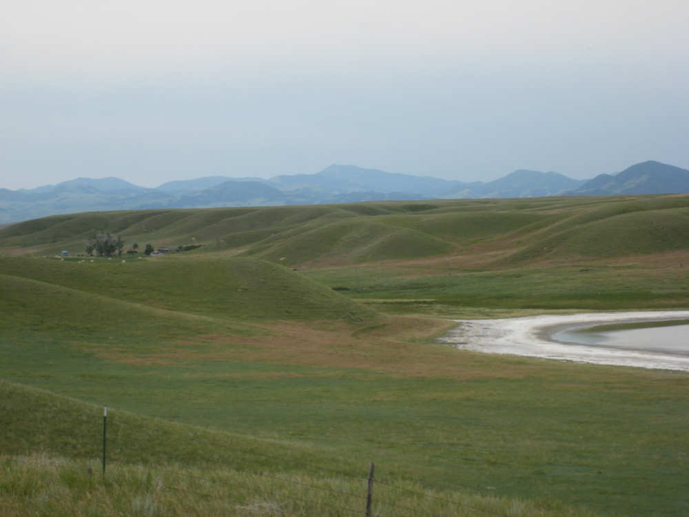
Alkali leaching out of the soil makes these dry lakes all white |

Information about the butte we've been approaching - Square Butte |
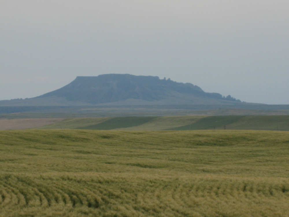
And here it is, closer up |
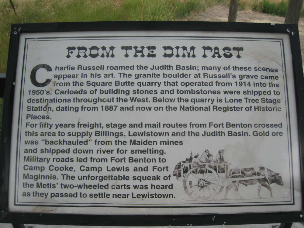
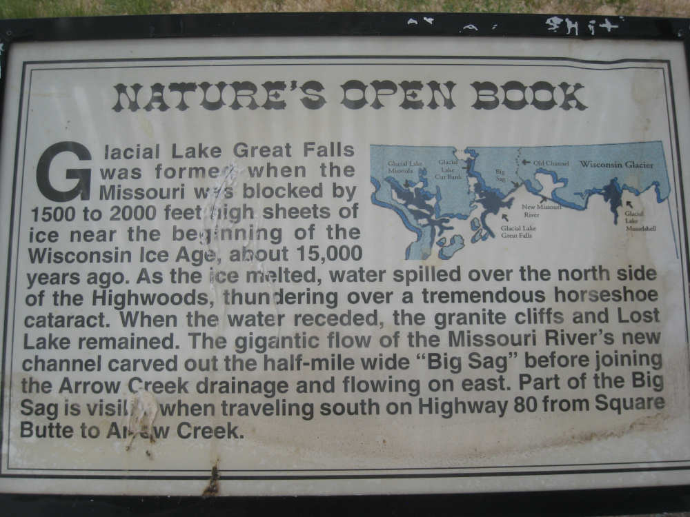
More historic tidbits about the area |
|

|
|
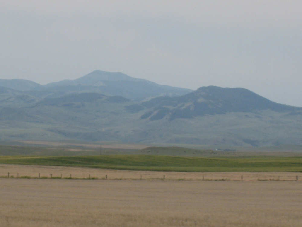
A close up of the Highwood Mountains off to our right |
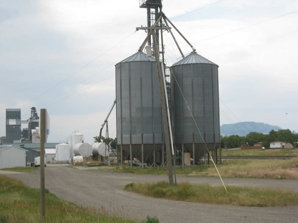
Big grain silos in Geraldine - our lunch town |
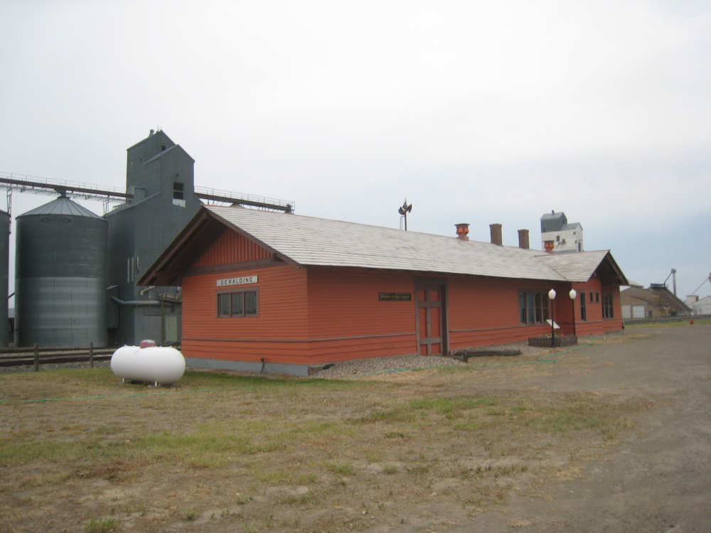
The Geraldine train depot |
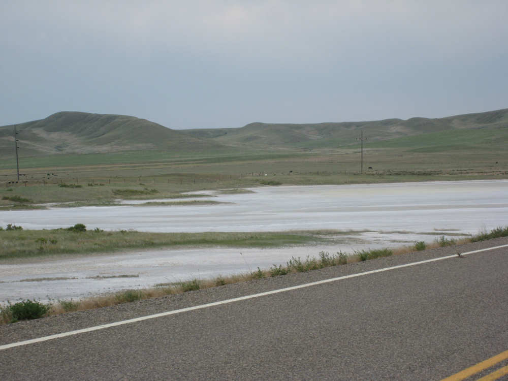
Dry alkali lakes... |

Interesting hills |
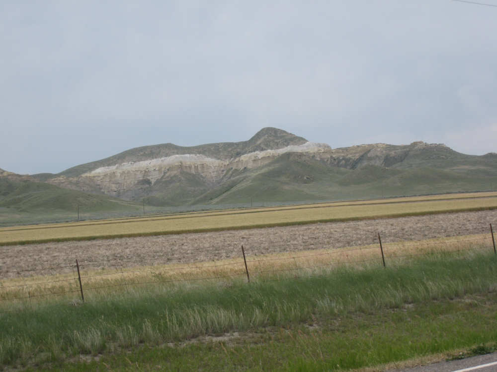
A layer of white rock runs through the mountains to our left |
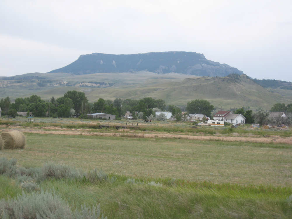
Square Butte looms over the small town of Square Butte |

More mountains with the white rock running through them |

We were pleased that we did the hill in half the time it took Mr. Stuart |
We could see the road from the sign below - the white ribbon going up |
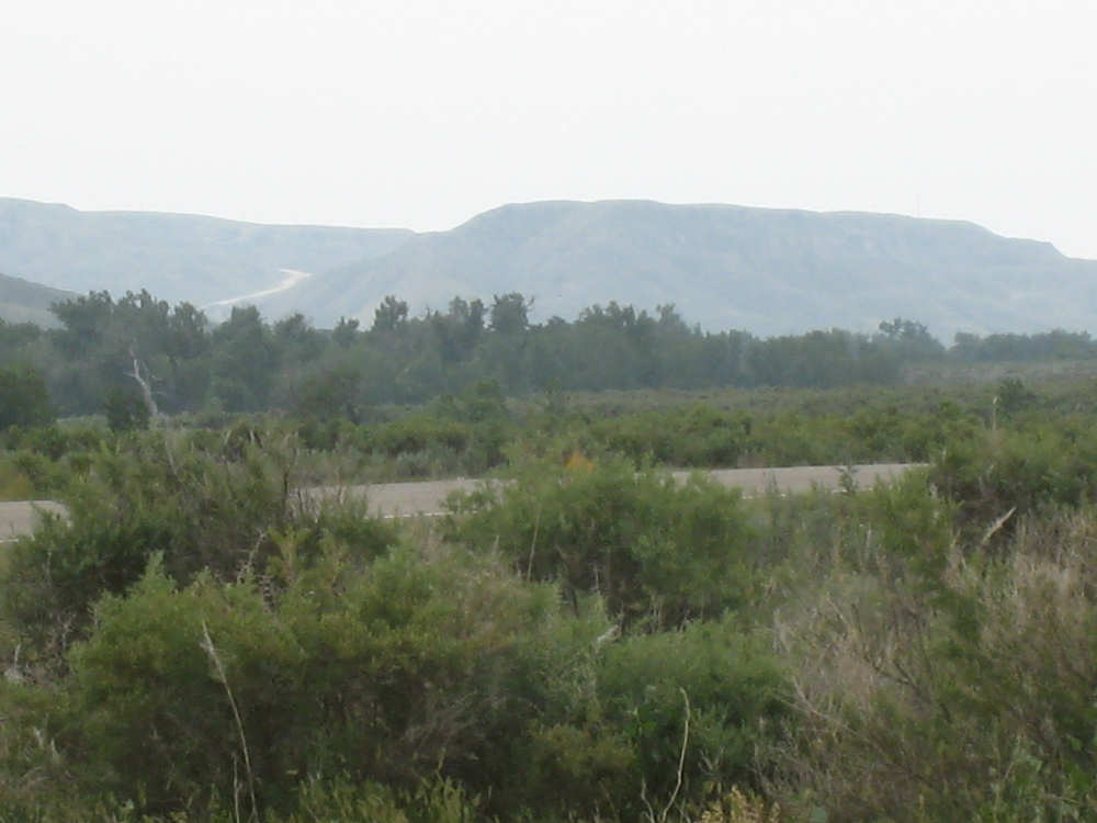
Rippled mountains and sage brush below as we neared the climb |

|
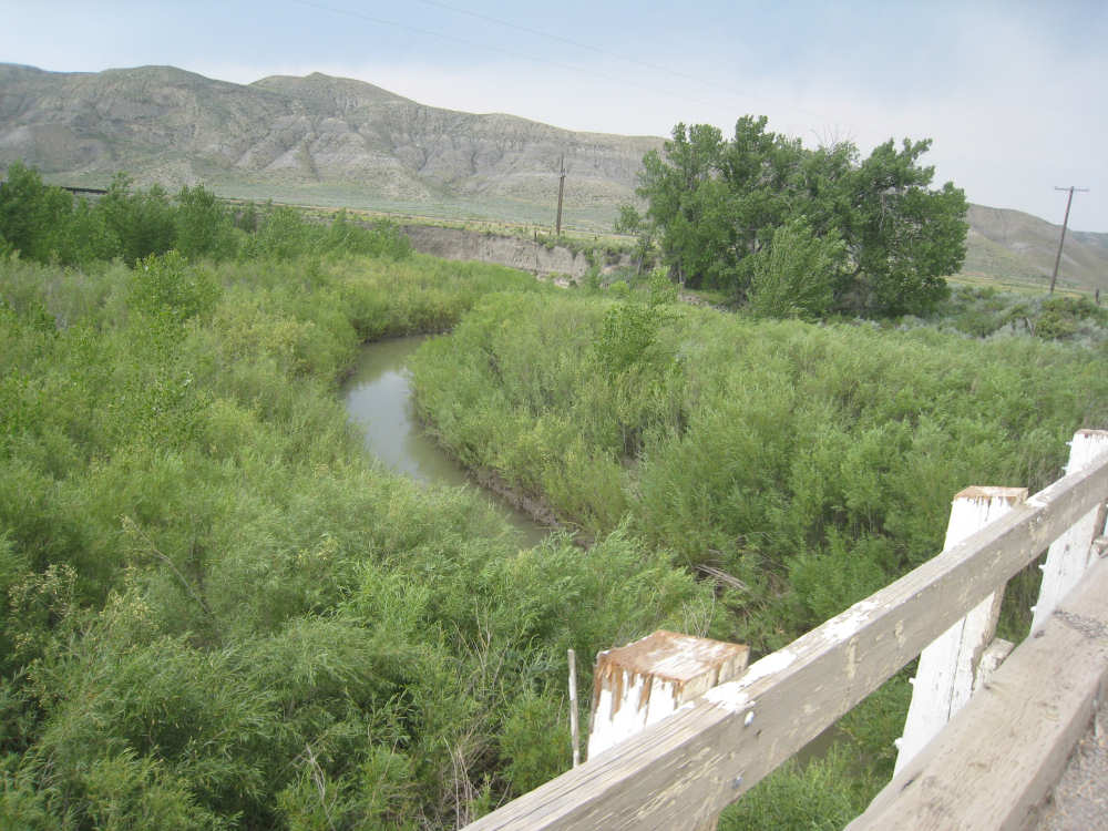
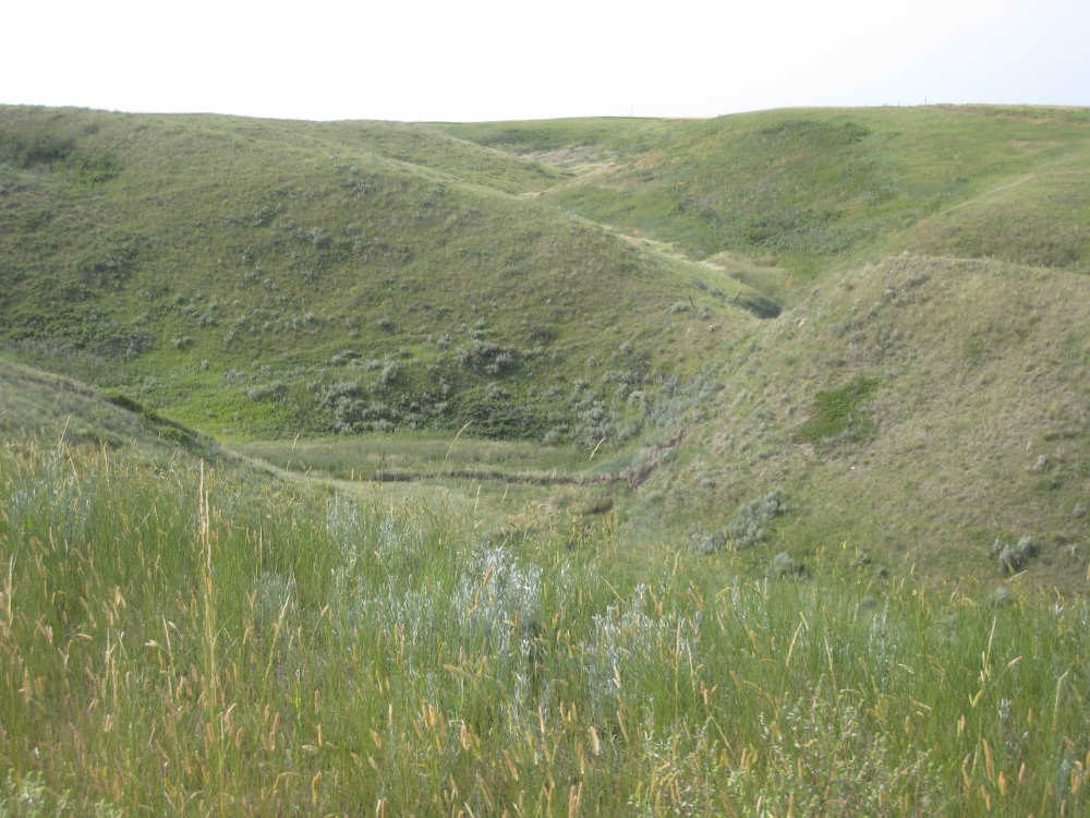
The infamous Arrow Creek barely makes it through all the brush |

About to start up the hill |
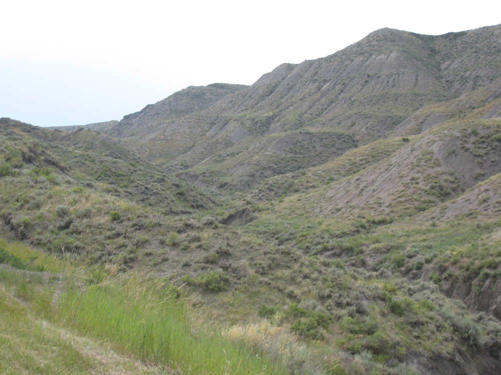
Beautiful hills and ravines going up the Arrow Creek hill |
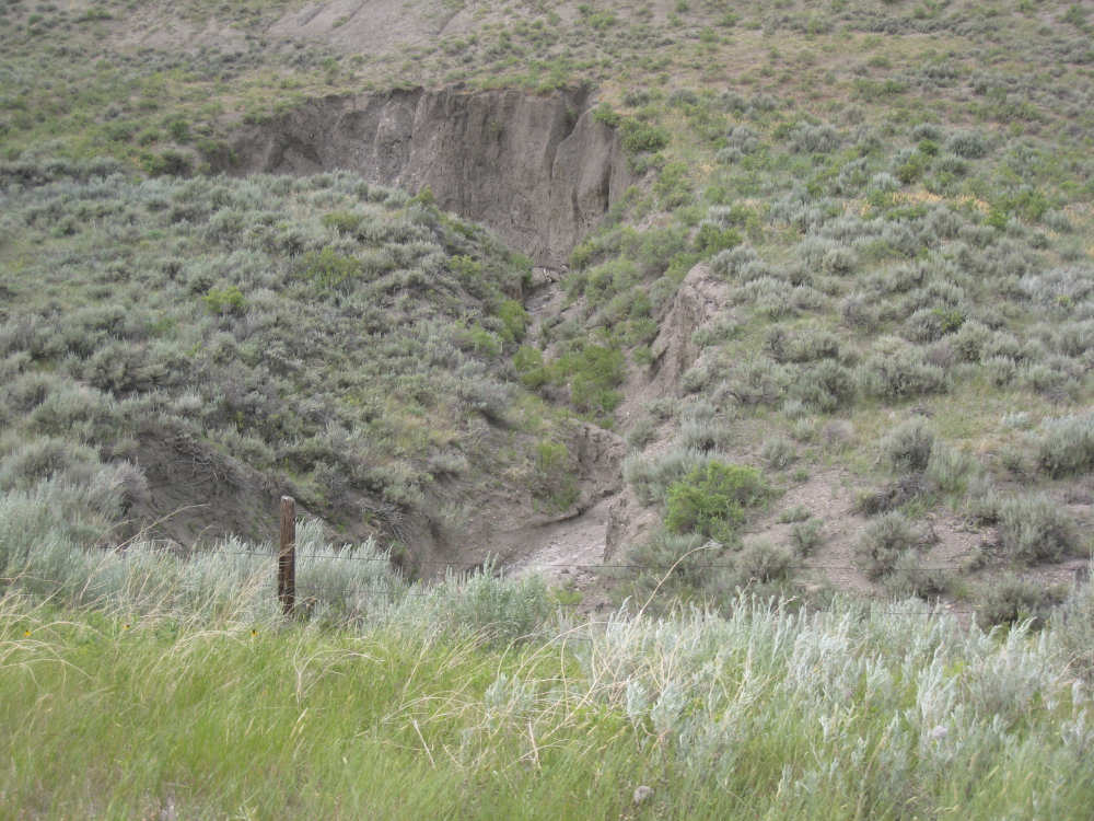
Deep ditches were carved out by the little streams running down the hill |

One of the rough gravel spots on the hill - and there was more climb ahead |
Looking back down the hill |

The surrounding hills continue to be spectacular |
At the top, looking back on Square Butte... |
and looking forward to... |
more flat fields of grain |